Monzambano
| Monzambano | ||
|---|---|---|

|
|
|
| Country | Italy | |
| region | Lombardy | |
| province | Mantua (MN) | |
| Local name | Monsambàn | |
| Coordinates | 45 ° 23 ' N , 10 ° 42' E | |
| height | 88 m slm | |
| surface | 29.9 km² | |
| Residents | 4,977 (Dec. 31, 2019) | |
| Population density | 166 inhabitants / km² | |
| Post Code | 46040 | |
| prefix | 0376 | |
| ISTAT number | 020036 | |
| Popular name | Monzambanesi | |
| Patron saint | Bartholomew | |
| Website | Monzambano | |
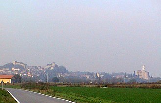
Monzambano (formerly: Castellaro ) is a northern Italian municipality with 4977 inhabitants (as of December 31, 2019) in the province of Mantua in Lombardy . The municipality is located about 26 kilometers north-northwest of Mantua on the Mincio and directly borders the provinces of Brescia and Verona . Monzambano is part of the Mincio Regional Park .
Fractions are Castellaro Lagusello, Olfino and Pille. In Castellaro Lagusello there are prehistoric pile dwellings , which are a UNESCO World Heritage Site Prehistoric pile dwellings around the Alps and the association I borghi più belli d'Italia (The most beautiful places in Italy).
Trivia
Severinus de Monzambano , mentioned by Samuel von Pufendorf , under whose name he also published his imperial constitution, is an invention of Pufendorf.
Individual evidence
- ↑ Statistiche demografiche ISTAT. Monthly population statistics of the Istituto Nazionale di Statistica , as of December 31 of 2019.
- ↑ List of UNESCO
- ^ I borghi più belli d'Italia. Borghipiubelliditalia.it, accessed July 30, 2017 (Italian).


