Nandrin
| Nandrin | ||
|---|---|---|

|

|
|
|
|
||
| State : |
|
|
| Region : | Wallonia | |
| Province : | Liege | |
| District : | Huy | |
| Coordinates : | 50 ° 30 ′ N , 5 ° 25 ′ E | |
| Area : | 35.90 km² | |
| Residents: | 5753 (Jan. 1, 2019) | |
| Population density: | 160 inhabitants per km² | |
| Post Code: | 4550 | |
| Prefix: | 085 | |
| Mayor: | Joseph Nandrin (UPN) | |
Local government address : |
Administration communale Place Ovide Musin, 1 4550 Nandrin |
|
| Website: | www.nandrin.be | |
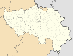
Nandrin is a municipality in the Belgian province of Liege . It consists of the localities of Nandrin, Saint-Séverin-en-Condroz, Villers-le-Temple, Yernée-Fraineux and part of d'Abée-Scry (Quatre Bras) .
Attractions
- In the center of Nardin is the Donjon de Nandrin , built in the 13th century by Baudouin de Saint-Servais.
- The remainder of the Commandery of the Knights Templar , Manoir de la Tour and Château de la Tour-au-Bois are located in the Villers-le-Temple district, which originated from the Templar Order .
- in the district of Yernée-Fraineux is the Château de Yernée and the Château de Fraineux, both from the 18th century.
Web links
Commons : Nandrin - collection of images, videos and audio files

