Aywaille
| Aywaille | ||
|---|---|---|

|

|
|
|
|
||
| State : |
|
|
| Region : | Wallonia | |
| Province : | Liege | |
| District : | Liege | |
| Coordinates : | 50 ° 28 ' N , 5 ° 41' E | |
| Area : | 79.97 km² | |
| Residents: | 12,436 (Jan 1, 2019) | |
| Population density: | 156 inhabitants per km² | |
| Post Code: | 4920 | |
| Prefix: | 04 | |
| Mayor: | Philippe Dodrimont | |
Local government address : |
Rue de la Heid, 8 4920 Aywaille |
|
| Website: | www.aywaille.be | |
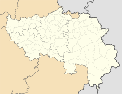
Aywaille is a Belgian municipality in the province of Liege .
It is located in the Amel valley at the foot of the Ardennes and is a place with a tourist background. The main attraction are the Remouchamps caves . The place is crossed several times a year in some great cycling classics in order to climb the famous Côte de la Redoute .
During the municipal reform on January 1, 1977, the previously independent municipalities Sougné-Remouchamps, Deigné, Harzé and Ernonheid were incorporated.
traffic
Aywaille has an express train stop on the Rivage – Trois Ponts line .
The E 25 motorway runs in a north-south direction through the municipality over a distance of 11 km and has two motorway exits in Aywaille. The N30 runs parallel to the motorway in parts. North it leads to Liège (30 km), south it leads via Manhay and Houffalize to Bastogne (65 km).
Web links
Individual evidence
- ^ Commune d'Aywaille . Aywaille.be. Retrieved June 24, 2010.

