Juprelle
| Juprelle | ||
|---|---|---|

|

|
|
|
|
||
| State : |
|
|
| Region : | Wallonia | |
| Province : | Liege | |
| District : | Liege | |
| Coordinates : | 50 ° 43 ' N , 5 ° 32' E | |
| Area : | 35.36 km² | |
| Residents: | 9295 (Jan 1, 2019) | |
| Population density: | 263 inhabitants per km² | |
| Post Code: | 4450-53, 4458 | |
| Prefix: | 04 | |
| Mayor: | Christine Servaes | |
Local government address : |
Administration Communale Rue de l'Eglise, 20 4450 Juprelle |
|
| Website: | www.juprelle.be | |
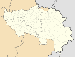
Juprelle ( Walloon Djouprele ) is a francophone Belgian municipality in the Wallonia region . It is located in the province of Liège and belongs to the arrondissement of Liège .
The community consists of the main town and seven other districts.
It is located in the greater Liège area , a good eight kilometers northwest of the city center, eight kilometers southeast of the city of Tongeren , 18 km southwest of the Dutch city of Maastricht and 82 km east of Brussels .
At Boirs and Liers there are motorway exits on the A13 / E 313 and at Rocourt and Hognoul on the A3 / E 40 .
There is a regional train station in Tongeren and the next train station with national long-distance train connections in Liège.
There is a regional airport near Liège and an international airport near the capital, Brussels.
Web links
- Official website of the municipality (French)

