Hannut
| Hannut | ||
|---|---|---|

|

|
|
|
|
||
| State : |
|
|
| Region : | Wallonia | |
| Province : | Liege | |
| District : | Waremme | |
| Coordinates : | 50 ° 40 ′ N , 5 ° 5 ′ E | |
| Area : | 86.53 km² | |
| Residents: | 16,571 (Jan 1, 2019) | |
| Population density: | 192 inhabitants per km² | |
| Post Code: | 4280 | |
| Prefix: | 019 | |
| Mayor: | Emanuelle Douette ( MR ) | |
Local government address : |
Administration Communale Rue de Landen, 23 4280 Hannut |
|
| Website: | www.hannut.be | |
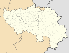
Hannut ( Walloon Haneù , Dutch Hannuit ) is a Belgian city (city title since 1985) in the Wallonia region . It is located in the province of Liège and is 26 kilometers northeast of Namur , 34 kilometers west of Liège and 54 kilometers southeast of Brussels .
The next motorway exit at Walshouten on the A3 / E 40 is 4 kilometers north; the next regional train station is 8 kilometers north in Landen . The Landen - Hannut - Wanze branch line no longer has any passenger traffic.
The first tank battle of the Second World War between German and French units took place in the Battle of Hannut from May 12 to 14, 1940 .
Web links
Commons : Hannut - collection of pictures, videos and audio files
Wikisource: Hannut in the Topographia Circuli Burgundici (Mathäus Merian) - sources and full texts
- Official website of the city (French)
