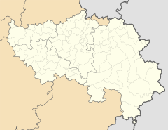
Anthisnes
| Anthisnes | ||
|---|---|---|

|

|
|
|
|
||
| State : |
|
|
| Region : | Wallonia | |
| Province : | Liege | |
| District : | Huy | |
| Coordinates : | 50 ° 29 ′ N , 5 ° 31 ′ E | |
| Area : | 37.08 km² | |
| Residents: | 4189 (Jan. 1, 2019) | |
| Population density: | 113 inhabitants per km² | |
| Post Code: | 4160 (Anthisnes) 4161 (Villers-aux-Tours) 4162 (Hody) 4163 (Tavier) |
|
| Prefix: | 04 | |
| Mayor: | Marc Tarabella | |
Local government address : |
Rue de l'Hôtel de Ville 1 4160 Anthisnes |
|
| Website: | www.anthisnes.be | |
Anthisnes is a municipality in the Belgian province of Liege . It has been made up of the localities of Anthisnes, Hody, Villers-aux-Tours and Tavier since the territorial reform in 1977.
Attractions
- In the center of Anthisnes the Château de l'Avouerie from the 17th century, where a is the Museum of beer is. Also in the village is the Saint-Laurent Abbey (17th century). A little further to the east of the city is the Château d'Ouhar. Ferme-Château de Limont is a fortified farm north of the city in the hamlet of Limont .
- The fortified farm Ferme-Château de Tavier and the Xhos Castle , both from the 17th century, are located in the district of Tavier .
Web links
Commons : Anthisnes - collection of images, videos and audio files
- Website of the municipality (French)

