Amay
| Amay | ||
|---|---|---|

|

|
|
|
|
||
| State : |
|
|
| Region : | Wallonia | |
| Province : | Liege | |
| District : | Huy | |
| Coordinates : | 50 ° 33 ' N , 5 ° 19' E | |
| Area : | 27.61 km² | |
| Residents: | 14,412 (Jan 1, 2019) | |
| Population density: | 522 inhabitants per km² | |
| Height: | 132 m | |
| Post Code: | 4540 | |
| Prefix: | 085 | |
| Mayor: | Jean-Michel Javaux ( Ecolo ) | |
Local government address : |
Administration Communale Chaussée Freddy Terwagne, 76 4540 Amay |
|
| Website: | www.amay.be | |
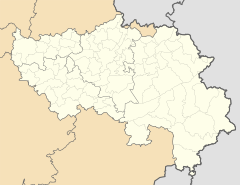
Amay is a Belgian municipality in the Wallonia region . It is located in the province of Liège and has 14,412 inhabitants (as of January 1, 2019) and an area of 27.61 km². The place in the valley of the Meuse (French: Meuse) lies at an altitude between 65 meters (level of the Meuse) and 245 meters on the southern mountain ranges.
Liège is 20 kilometers northeast, Namur 35 kilometers southwest and Brussels 75 kilometers northwest. The nearest motorway junction is Villers-le-Bouillet on the Belgian A15 motorway . The place has its own regional train station on the Namur-Liège line.
Community structure
The following places belong to the parish: Amay, Ampsin , Flône , Jehay and Ombret-Rawsa .
Sarcophagus of St. Chrodoara
A sarcophagus from the Merovingian era, the Chrodoara sarcophagus , was found in the choir of the collegiate church of Saint-Georges in Amay and is on display there.
Jehay moated castle
The area was already inhabited in the Mesolithic (between 10,000 and 4,500 BC), as evidenced by the remains of a pile dwelling village.
The 16th century mansion has a striking façade in a checkerboard pattern and a spacious park. The castle houses an extensive collection of contemporary interiors, silver and goldsmith work.
Personalities
- Béatrice Libert (* 1952), poet and writer
literature
- Sigfried Jan de Laet: Amay, Belgium . In: Richard Stillwell et al. a. (Ed.): The Princeton Encyclopedia of Classical Sites. Princeton University Press, Princeton NJ 1976, ISBN 0-691-03542-3 .
Web links
- Official website of the municipality (French)


