Gulf Country
| Gulf Country | |
 Overview of the regions of Queensland, including North West Queensland as part of the Gulf Country |
|
| structure | |
| State : |
|
| State : |
|
| Dates and numbers | |
| Area : | 186,000 km² |
| Population density : | 0 inhabitants / km² |
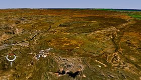
 The area around Lawn Hill Crater |
|
Coordinates: 17 ° 52 ′ S , 140 ° 10 ′ E
The Gulf Country , also called Gulf Savannah , is the name of a scrubland and savannah region around the Gulf of Carpentaria in northwest Queensland and the eastern Northern Territory on the north coast of Australia . In Queensland, it is the North West Queensland statistical region .
description
Gulf Country is a dry savannah between the Arnhem Land and the Top End in the western Northern Territory and the Cape York Peninsula of Far North Queensland in the east. In the south and east of the region is the plateau with the Australian endemic Mitchell Grass , a sweet grass , and the Einasleigh Uplands . In the Northern Territory is the Gulf Fall, with mountain slopes and sandstone gorges that drain into the Gulf. In the region, cattle breeding and mining are the main economic activities.
The region is 186,000 km² in size. The landscape is generally flat and the deeper tropical savannah is cut by rivers that drain the monsoon rains into the Gulf, fill the coastal tidal flats and irrigate the rainforests. The Sir Edward Pellew Islands and the Wellesley Islands are off the Gulf Coast.
The main cities are Mount Isa , Doomadgee , Cloncurry , Camooweal , Kowanyama , Karumba , Normanton and Burketown . Karumba Port is one of the most heavily used livestock ports in Australia. The city of Mount Isa is known for its important raw material deposits. The region crosses the Savannah Way .
The prevailing local climate is hot with a dry and monsoon season . The dry season from April to November is characterized by a very dry southeast or east wind, which is created by a winter high pressure system in the south. The rainy season lasts from December to March and is characterized by a steamy monsoon air movement. The rainy season can be very changeable at Burketown , which is typical for the region. The precipitation of the different rainy seasons ranges from 150 to more than 2000 mm. The annual rainfall is low, however, ranging from 750 mm on the coast to 500 mm inland; However, in the rainy season it is violent everywhere, low-lying areas are flooded and roads can also be destroyed. Cyclones also appear in the Gulf from November to April .
In September and October there is the so-called Morning Glory Cloud on the Southern Gulf. The best place to see this phenomenon is in the Burketown area in the morning hours.
history
The Dutch Willem Janszoon undertook the first voyage of discovery in this area in 1606. In 1623 he was followed by his compatriot Jan Carstenszoon (also Carstensz ), who named the Gulf after Pieter de Carpentier , who was governor general of the Dutch East Indies at the time . Also Abel Tasman explored the coast in 1644. Later in 1802 and 1803, Matthew Flinders came to the area to explore and map it.
The first to explore the country was the Prussian Ludwig Leichhardt , who crossed the area in 1844 and 1845. He was followed by Augustus Gregory on the North Australian Expedition in 1856 and then on the Burke Wills Expedition in 1861 . John McKinlay , Frederick Walker and William Landsborough conducted various expeditions in the region in 1861 and 1862 to find the lost explorers O'Hara Burke and William John Wills .
When dairy farmers first settled in this area, there was significant violent confrontation with the local Aborigines . Historian Tony Roberts described the massacres and fighting in the Gulf Country in his book Frontier Justice .
ecology
flora
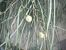
In the Gulf Country there is no mountain range that mitigates the rainfall along the coastline and the transition from the mangrove coasts to the scrubland with the evergreen trees of Acacia stenophylla and the adjacent areas of Australia. There are 19 major bird migration areas at the estuaries along the Gulf Coast. including the Gregory River - Nicholson River - estuary and the Roper River in Limmen Bight . The patchwork of rainforest habitats partially prevents bushfires from developing. In the savannah, after the rains, the Dicanthium Bluegrass grows in one of the largest grasslands in Australia. The sandstone gorges of the Gulf Fall are home to specific wildlife. Finally, the Pellew Islands also have mangrove forests and a dense tree savannah.
fauna
The area is home to numerous endangered species, such as the endemic Carpentarian Rock Rat ( Zyzomys palatalis ) and endemic reptiles such as the Carpentarian lerista skink . The mudflats and salt pans on the coast are home to waterfowl like the magpie goose . An endemic bird in the grasslands is the Carpentarian Grasswren , which suffers from the alternating bushfires that burn the grass and allow it to grow again as these fires reduce their habitat.
Hazards and protection
In Culf Country there are large unspoiled landscapes, but the Viehüberweidung and the entry of different forage grass varieties affect both the grasslands, which is vulnerable to bush fires, as well as the wetlands. Another common weed is Cryptostegia grandiflora .
Protected areas are Finucane Island National Park , States River National Park , Boodjamulla National Park (formerly Lawn Hill National Park), the fossil sites on the UNESCO World Heritage List at Riversleigh , Camooweal Caves National Park and Mitchell-Alice- Rivers National Park on the Queensland side . Finally, the Barranyi National Park is one of the national parks on the Pellew Islands. However, the wetlands on the coast are hardly protected.
The Lawn Hill Crater , an impact crater , is also located in the Gulf Country and is surrounded by a ring of limestone hills surrounded.
List of major rivers
- Top end
- Gulf Country
- Cape York Peninsula
Web links
- savanna.org.au : Savanna Explorer
Individual evidence
- ^ Gulf Savannah Australia . Gulf Savannah Development Inc .. Retrieved January 31, 2008.
- ^ Rangelands Overview: Gulf Plains . In: Australian Natural Resources Atlas . Department of the Environment, Water, Heritage and the Arts. Archived from the original on March 13, 2010. Info: The archive link was inserted automatically and has not yet been checked. Please check the original and archive link according to the instructions and then remove this notice. Retrieved January 31, 2008.
- ↑ Skeletons are out . In: The Age , Fairfax Digital , July 2, 2005. Retrieved January 31, 2008.
- ^ Environment Australia. 2001: A Directory of Important Wetlands in Australia, Third Edition. Environment Australia, Canberra, Australia .
- ^ Australian Surveying and Land Information Group. 1990. Atlas of Australian Resources: Vegetation. Australian Government Publishing Service, Canberra, Australia
- ↑ nt.gov.au ( Memento of the original from March 20, 2011 in the Internet Archive ) Info: The archive link was inserted automatically and has not yet been checked. Please check the original and archive link according to the instructions and then remove this notice. : Barranyi National Park , in English, accessed June 24, 2012

