Obergoms
| Obergoms | |
|---|---|
| State : |
|
| Canton : |
|
| District : | Goms |
| BFS no. : | 6076 |
| Postal code : | 3988 Obergesteln 3988 Ulrichen 3999 Belvedere ( Furka ) 3999 Gletsch 3999 Grimsel Passhöhe 3999 Oberwald |
| Coordinates : | 669 816 / 154 089 |
| Height : | 1377 m above sea level M. |
| Height range : | 1339–3628 m above sea level M. |
| Area : | 155.93 km² |
| Residents: | 664 (December 31, 2018) |
| Population density : | 4 inhabitants per km² |
| Website: | www.obergoms.ch |
|
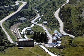
Gletsch with Grimsel and Furkapassstrasse |
|
| Location of the municipality | |
Obergoms is a municipal and civil parish in the Goms district of the Swiss canton of Valais . It was created on January 1, 2009 from the merger of the previously independent municipalities of Ulrichen , Obergesteln and Oberwald .
geography
The municipality of Obergoms is located in the upper part of the Valais below the Rhone Glacier on the upper reaches of the Rhone . It includes the farthest Rotten / Rhone valley between Ulrichen and Gletsch and the secondary valleys between Nufenen , Furka , Grimsel and the Dammastock .
Climate table
| Obergoms (Ulrichen), 1981-2010 | ||||||||||||||||||||||||||||||||||||||||||||||||
|---|---|---|---|---|---|---|---|---|---|---|---|---|---|---|---|---|---|---|---|---|---|---|---|---|---|---|---|---|---|---|---|---|---|---|---|---|---|---|---|---|---|---|---|---|---|---|---|---|
| Climate diagram | ||||||||||||||||||||||||||||||||||||||||||||||||
| ||||||||||||||||||||||||||||||||||||||||||||||||
|
Average monthly temperatures and precipitation for Obergoms (Ulrichen), 1981–2010
Source:
|
||||||||||||||||||||||||||||||||||||||||||||||||||||||||||||||||||||||||||||||||||||||||||||||||||||||||||||||||||||||||||||||||||||||||||||||||||||||||||||||||||||||||||||||||||||
Attractions
traffic
Obergoms is integrated into the public transport network by the Matterhorn Gotthard Railway . All three villages (Ulrichen, Obergesteln and Oberwald) have their own train station on the route. The loading point for car loading through the Furka base tunnel to Realp in the canton of Uri is located in Oberwald .
The municipality of Obergoms is the starting point of the three pass roads over the Grimsel pass , the Furka and the Nufenen and the path over the Gries pass .
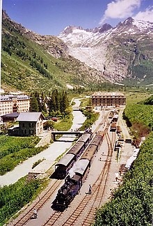
Since 2011, the steam train has been running from Oberwald VS in summer over the old Furka mountain route to Realp in the canton of Uri .
literature
- Editor: Obergoms. In: Historical Lexicon of Switzerland . 2017 .
Web links
Individual evidence
- ↑ Permanent and non-permanent resident population by year, canton, district, municipality, population type and gender (permanent resident population). In: bfs. admin.ch . Federal Statistical Office (FSO), August 31, 2019, accessed on December 22, 2019 .
- ↑ Climate table. In: meteoschweiz.admin.ch. meteoschweiz, accessed on December 6, 2018 .
- ↑ Furka Mountain Line Steam Railway (DFB)


