Osteel
| coat of arms | Germany map | |
|---|---|---|

|
Coordinates: 53 ° 32 ' N , 7 ° 15' E |
|
| Basic data | ||
| State : | Lower Saxony | |
| County : | Aurich | |
| Joint municipality : | Brookmerland | |
| Height : | 1 m above sea level NHN | |
| Area : | 19.89 km 2 | |
| Residents: | 2162 (Dec. 31, 2019) | |
| Population density : | 109 inhabitants per km 2 | |
| Postal code : | 26529 | |
| Primaries : | 04934, 04920, 04931 | |
| License plate : | AUR, NOR | |
| Community key : | 03 4 52 021 | |
| Community structure: | 2 districts | |
| Association administration address: | Am Markt 10 26529 Marienhafe |
|
| Mayoress : | Ida-Anna Bienhoff-Topp ( SPD ) | |
| Location of the municipality of Osteel in the Aurich district | ||
Osteel is a municipality in the Brookmerland municipality in the Aurich district in Lower Saxony . The village is located north of the Marienhafe Samtgemeindezentrum , with which it is structurally grown. The Schoonorth district, around three kilometers west of the old postal route, also belongs to Osteel.
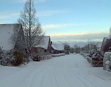
The village consists mainly of a purely residential area drawn along a length of about three kilometers on the Alter Postweg with several side streets. Trade is represented by a bakery, electrical goods stores, a fast food shop, a construction business, a building management company and an agricultural machinery business. There are also two used car dealers. The educational offer within the community includes a primary school and a kindergarten.
history
The village of Osteel is said to have been founded after 1164, when the coastal area was devastated by the Julian flood . The early settlement was on the edge of a high moor .
politics
Municipal council
The council of the municipality of Osteel consists of 13 councilors. This is the specified number for the member municipality of an integrated municipality with a population of 2001 up to 3000 inhabitants. The 13 council members are elected for five years each by local elections. The current term of office began on November 1, 2016 and ends on October 31, 2021.
The last local election on September 11, 2016 resulted in the following:
| Political party | Proportional votes | Number of seats | Change voices | Change seats |
|---|---|---|---|---|
| SPD | 60.4% | 8th | −3.1% | 0 |
| Brookmer Voting Association (BWG) | 19.4% | 2 | −1.8% | −1 |
| CDU | 12.5% | 2 | −1.5% | 0 |
| Alliance 90 / The Greens | 4.9% | 1 | + 4.9% | +1 |
The turnout in the 2016 local elections was 52.7%, below the Lower Saxony average of 55.5%. For comparison - in the previous municipal election on September 11, 2011, the turnout was 49.88%.
Mayor is Ida Bienhoff-Topp (SPD).
coat of arms
| Blazon : "In blue a golden hammer, which is exaggerated by a golden crown of leaves and a golden three-leaf clover on the handle." | |
| Justification of the coat of arms: The hammer and the crown are reminiscent of David Fabricius, whose father was a blacksmith. The shamrocks indicate agriculture. |
Attractions
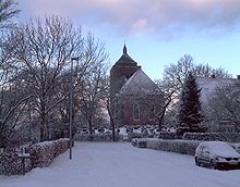
One of the parish's attractions is the 12th century Warnfried Church . The church is 63 meters long and is dedicated to St. Werenfried . The church organ is the second oldest in East Friesland . It was built in 1619 by master Edo Evers .
In front of the church is the monument to the astronomer David Fabricius , who pastor the congregation in the early 17th century. He not only discovered stars, but also drew one of the first maps of East Frisia. His son Johannes discovered the sunspots .
traffic
The capital, Osteel, is located on the federal highway 72 about six kilometers south of the old district town of Norden . The railway line between Emden and Norddeich Mole also runs through the community . After the station was closed in 1978, the next station is now in Marienhafe, three kilometers to the south. In the west of the community (district Schoonorth) also the state road 4 runs from Pewsum to the north.
Sons and daughters of the place
- Johannes Fabricius (1587–1617), astronomer, discoverer of sunspots
- Friedrich Vissering (1826–1885), member of the Reichstag
- Johannes Warns (1874–1937), Protestant theologian, Bible school teacher and director of the Wiedenest Bible School
- Dirk Agena (1889–1934), politician and member of the Reichstag
- Gerhard Harmannus Janssen (1914–2005), painter
- Siemen Rühaak (* 1950), actor
Other personalities in Osteel
- The reformer Andreas Bodenstein (around 1486–1541) (also called Andreas Karlstadt after his place of origin) spent a few months in the Schoonorth district of Osteel in 1529/30 under the code name Bauer Andrees .
- David Fabricius (1564–1617), astronomer and father of Johannes Fabricius
Web links
Individual evidence
- ↑ State Office for Statistics Lower Saxony, LSN-Online regional database, Table 12411: Update of the population, as of December 31, 2019 ( help ).
- ^ Lower Saxony Municipal Constitutional Law (NKomVG) in the version of December 17, 2010; Section 46 - Number of MPs , accessed on December 31, 2016.
- ↑ a b Samtgemeinde Brookmerland - District Council Election Osteel 2016 , accessed on December 31, 2016.
- ↑ hna.de: Local elections: All information, all results , accessed on December 31, 2016.
- ↑ Smid: East Frisian Church History. 1974, pp. 139f.


