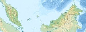
Pulau Bohey Dulang
| Pulau Bohey Dulang | ||
|---|---|---|
| Location of Pulau Bohey Dulang in Darvel Bay | ||
| Waters | Celebes Sea | |
| Geographical location | 4 ° 36 ′ 0 ″ N , 118 ° 47 ′ 0 ″ E | |
|
|
||
| length | 2.6 km | |
| width | 1.35 km | |
| surface | 2.7 km² | |
| Highest elevation | Gunung Boheydulong 353 m |
|
Pulau Bohey Dulang or Pulau Boheydulang is an island belonging to the Malaysian state of Sabah at the entrance to Darvel Bay, which is open to the Celebes Sea . The forested island is about 25 kilometers northeast of Semporna . The island extends 2.6 kilometers to the north and is up to 1.35 kilometers wide. The island is dominated by Gunung Boheydulong , which rises steeply to 353 meters and is already visible from Sibuku Bay due to its distinctive shape . There is a transmission mast on top. Together with Pulau Gaya , the island forms a crescent-shaped bay that opens to the south.
Individual evidence
- ↑ Information on Pulau Bohey Dulang in English .
- ↑ Sailing Directions (Enroute) - Borneo, Jawa, Sulawesi and NUsa Tenggara (PDF; 5.8 MB), United States Navy Publication 163, Sector 10, Page 286, 2002; Accessed August 24, 2012

