Pulau Sangai
| Pulau Sangai | ||
|---|---|---|
| Pulau Sangai as seen from Kampung Bahagian | ||
| Waters | Sulu Lake | |
| Geographical location | 5 ° 45 '27 " N , 118 ° 1' 14" E | |
|
|
||
| length | 330 m | |
| width | 110 m | |
| surface | 3 ha | |
| Highest elevation | 15 m | |
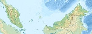
Pulau Sangai , including Pulau Shanghai called, is one to Malaysia owned island in the Sulu Sea and is located in the northern part of the Sandakan Bay, 500 meters east of timbang island .
description
The approximately 3 hectare island extends over a length of 330 meters and is up to 110 meters wide. The island is completely forested and rises up to 15 meters from the sea. There is a fishing village in the southwest.
Web links
Commons : Pulau Sangai - Collection of Images
Individual evidence
- ↑ State Land Surveying Office Malaysia (JUPEM): Topographic map 1:50 000, sheet 37 "Sandakan" ; Issue 1-PPNM, 2002
Remarks
- ↑ The value was approximately determined by determining the area of the satellite image from google maps

