Pulau Kalumpang (Sabah)
| Pulau Kalumpang | ||
|---|---|---|
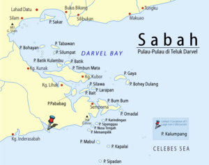
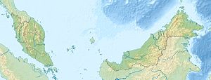
| Location of Pulau Kalumpang off the coast of Sabah | ||
| Waters | Celebes Sea | |
| Geographical location | 4 ° 19 ′ 56 " N , 118 ° 20 ′ 40" E | |
|
|
||
| length | 3 km | |
| width | 2.3 km | |
| surface | 4.5 km² | |
| Highest elevation | 85 m | |
Kalumpang ( Mal. Pulau Kalumpang ) is an island belonging to Malaysia in the Celebes Sea . It is located about 50 kilometers west of Semporna and 35 kilometers east of Tawau off the east coast of Borneo in the mouth of the Sungai Kalumpang .
description
The approximately 4.5 square kilometer island extends over a length of three kilometers and is up to 2.3 kilometers wide. It has the shape of a sloping wine goblet . The island rises up to 85 m from the sea. There is a small village on the north side.
Others
The island is sometimes confused with the island of the same name, belonging to the state of Perak , which is a well-known archaeological site.
Individual evidence
- ↑ Sailing Directions (Enroute) - Borneo, Jawa, Sulawesi and NUsa Tenggara (PDF; 5.8 MB), United States Navy Publication 163, sector 10, page 279, 2002; Accessed July 21, 2012
Remarks
- ↑ The values were approximately determined by evaluating the satellite image from google maps.

