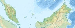
Pulau Timbun Mata
| Pulau Timbun Mata | ||
|---|---|---|
| Location of Pulau Timbun Mata in Darvel Bay | ||
| Waters | Celebes Sea | |
| Geographical location | 4 ° 39 ′ N , 118 ° 25 ′ E | |
|
|
||
| length | 30.1 km | |
| width | 9.7 km | |
| surface | 115 km² | |
| Highest elevation | 620 m | |
Pulau Timbun Mata is an island belonging to Malaysia in Darvel Bay, which is open to the Celebes Sea . The island is about 20 kilometers northwest of Semporna and is the largest island within Darvel Bay. It is mostly densely forested. Its maximum length is approx. 30.1 km, the greatest width approx. 9.7 km. From the flat west coast it rises steadily to Mount Tannabalu , which is located roughly in the middle of the island. The 620 m high, conical mountain is an extinct volcano. A second peak - the 489 m high Mount Sedungal - rises at the eastern end of the island. The island is called by a narrow straitTrusan Sigalong separated from the mainland.
history
The island has been inhabited for a long time. There are several settlements on the island, Mantandak in the west, Lakai Lakai in the north, Dap Dap in the northeast and Tambanan in the east. There are also several illegal settlements in the southeast of the island.
Teak was planted on the island from the 1880s. In 1930 Pulau Timbun Mata was declared a forest reserve. The teak forests were then regularly monitored, but the population was significantly reduced by road construction and illegal logging.
flora
The island's vegetation consists of mixed dipterocarp forests "(MDF)" , swamp forests, mangrove forests and secondary forests .
The lowland MDF are dominated by Parashorea malaanonan , palm trees and lianas . S. guiso , Cynometra elmeri , Pterocymbium tinctorum and Pterospermum stapfianum are found on steeper sections . On the less steep sections, Parashorea malaanonan is supported by Rubroshorea species such as S. johorensis , S. leprosula , S. smithiana , S. ovalis and occasionally Dr. lanceolata and D. caudiferus . Localized occurrences of Drypetes , Cynometra and Dialium on dry hills - especially in the absence of P. malaanonan - indicate secondary forest . Diospyros macrophylla is the most common species in the forest reserve.
In the freshwater swamp forests, Shorea leprosula and Dipterocarpus applanatus are found in the upper layers and a variety of Syzygium sp. , Diospyros sp. and Annonaceae in the undergrowth. The island has an open Alstonia swamp forest with Parkia sp. and Glochidion sp. , a mixed swamp forest with Syzygium and Diospyros sp. and a swamp forest with Nauclea sp. and Dipspyros sp. out.
The mangrove forests consist of typical mangrove species and nipa palms , but not to the same extent as on the coasts of the mainland. The typical species in the intertidal zone are Nypa fruticans , Rhizophora mucronata , Rhizophora apiculata , Bruguiera parviflora and Excoelania agallacha occur in tidal flats. In drier areas one can find Ceriops tagal , Xylocarpus granatium and Avicenia alba and the fern Acrosticum aureum .
Individual evidence
- ↑ Sailing Directions (Enroute) - Borneo, Jawa, Sulawesi and Nusa Tenggara (PDF file; 5.49 MB), United States Navy Publication 163, sector 10, page 286, 2002; Accessed August 24, 2012
- ↑ a b c d e Sabah Forestry Department: Conservation Areas Information and Monitoring System , accessed February 11, 2012
Remarks
- ↑ The values were approximately determined by evaluating the satellite image from google maps.

