Pulau Sakar
| Pulau Sakar | ||
|---|---|---|
| Location of Pulau Sakar in Darvel Bay | ||
| Waters | Celebes Sea | |
| Geographical location | 4 ° 58 ′ 0 ″ N , 118 ° 20 ′ 0 ″ E | |
|
|
||
| length | 9.5 km | |
| width | 4 km | |
| surface | 18 km² | |
| Highest elevation | 218 m | |
| main place | Kp. Tanjung Paras | |
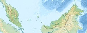
Pulau Sakar is an island belonging to Malaysia in Darvel Bay, which is open to the Celebes Sea . The irregularly shaped island is about 3.5 km south of Lahad Datu and is the second largest island within Darvel Bay. It is mostly densely forested. Its maximum length in the direction of the WSW is approx. 9.5 km, the greatest width approx. 4 km. A narrow, shallow strait a few hundred meters wide separates the island from the mainland. In the middle of its south side a noticeable hump rises up to a height of 218 m.
history
The island has been inhabited for a long time. There are several settlements on the island's coast; Kg.Look Bikin, Kg.Tambak Buaya, Kg.Tanjung Batu, Kg.Tanjung Paras, Kg.Tarwag and Kg.Look Terusa.
Infrastructure
There are no roads on the island. The traffic between the villages is exclusively by boat. The island is equipped with two schools, a mosque and a meeting hall. The fisheries authority also has an office there (Stesen Jabatan Perikanan) .
economy
The inhabitants of the island earn their livelihood mainly by fishing and aquaculture operations .
In the southwest of the island there is a 760 hectare rainforest reserve (Class VI Virgin Jungle Reserve). The jungle reserve is known for the massive occurrence of the "fire flies" ( Pteroptyx gelasina and Pteroptyx similis ). The special property of this subspecies of fireflies is that the insects can rhythmically synchronize their light emission. Night-time observation of fireflies from a boat is an important component of ecotourism in the region.
Individual evidence
- ↑ Sailing Directions (Enroute) - Borneo, Jawa, Sulawesi and Nusa Tenggara (PDF; 5.8 MB) United States Navy Publication 163, 2002, sector 10, p. 286; Retrieved August 24, 2012
- ↑ a b Topographic map 1: 200,000: Negeri Sabah Bahagian Tawau Daerah Lahad Datu ; Edited by Jabatan Ukur & Permetaan Malaysia, 1st edition, 2011
- ↑ VK Chey: Fireflies of Pulau Sakar . Sepilok Bulletin Volume 13 & 14, No. 1, June 2011, pp. 27-32
- ^ J. Buck, E. Buck: Mechanism of rhythmic synchronous flashing of fireflies . In: Science , March 22, 1968; 159 (3821), pp. 1319-1327, PMID 5644256 .

