Pulau Pababag
| Pulau Pababag | ||
|---|---|---|
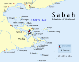
| Location of Pulau Pababag in Darvel Bay | ||
| Waters | Celebes Sea | |
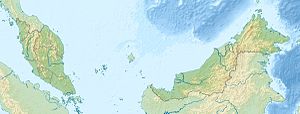
| Geographical location | 4 ° 32 '0 " N , 118 ° 29' 0" E | |
|
|
||
| length | 4.5 km | |
| width | 2.5 km | |
| surface | 9 km² | |
| Highest elevation | 10 m | |
| main place | Kg.Kababak | |
Pulau Pababag is an island belonging to the Malaysian state of Sabah in Darvel Bay, which is open to the Celebes Sea . The island is about 13 kilometers northwest of Semporna . The island extends 4.5 kilometers to the north and is up to 2.5 kilometers wide. The island is separated from the mainland in the west by a strait about 600 meters wide. To the east is Pulau Bait 1.6 kilometers away .
Individual evidence
- ^ Topographic map 1: 90,000: Negeri Sabah Bahagian Tawau Daerah Semporna ; Eds. Jabatan Ukur & Permetaan Malaysia, 1st edition, 2010
Remarks
- ↑ The values were approximately determined by evaluating the satellite image from google maps.

