Pulau Omadal
| Pulau Omadal | ||
|---|---|---|
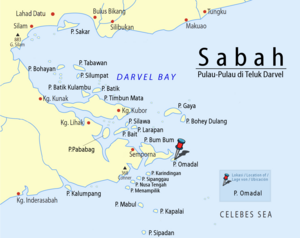
| Location of Pulau Bum Bum on the southeastern edge of Darvel Bay | ||
| Waters | Celebes Sea | |
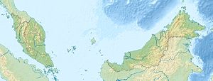
| Geographical location | 4 ° 25 ′ 0 ″ N , 118 ° 45 ′ 0 ″ E | |
|
|
||
| length | 1.6 km | |
| width | 1.6 km | |
| surface | 1.1 km² | |
| main place | Kg.Omadal | |
Pulau Omadal or Pulau Omadel is an island belonging to the Malaysian state of Sabah on the southeastern edge of Darvel Bay, which is open to the Celebes Sea . The island is located in the Semporna district of the Tawau Division . It is located about one kilometer southeast of Pulau Bum Bum and parts of it are densely forested. The island is irregularly shaped, but is reminiscent of an upside-down triangle with a bay on the west side. The edge lengths of this triangle are about 1.6 kilometers. The island is largely flat; the top height of the forest is given as 46 m. The island is separated from Pulau Bum Bum by a two kilometer wide strait.
Demographics
The island is populated on the western tip facing the neighboring island Pulau Bum Bum; mainly with Bajau . In addition to fishing, the cultivation and extraction of seaweed has recently become a source of income for the local population.
Attractions
A small tombstone museum has been set up on Pulau Omadal.
literature
- Yap Beng Liang: "Orang Bajau Pulau Omadal: aspek-aspek budaya" , Dewan Bahasa dan Pustaka, Kementerian Pendidikan, Malaysia, 1993, ISBN 9836224866
Individual evidence
- ↑ Sailing Directions (Enroute) - Borneo, Jawa, Sulawesi and Nusa Tenggara (PDF; 5.8 MB), United States Navy Publication 163, sector 10, page 283, 2002; Accessed August 24, 2012
- ↑ New Straits Times: Success story of seaweed farming ( page no longer available , search in web archives ) Info: The link was automatically marked as defective. Please check the link according to the instructions and then remove this notice. on May 16, 2003; Accessed August 28, 2012
- ↑ Tombstone Muzium At Pulau Omadal Semporna ; Accessed August 28, 2012
Remarks
- ↑ The values were approximately determined by evaluating the satellite image from google maps.

