Pulau Kalampunian
| Pulau Kalampunian | ||
|---|---|---|
| P. Kalampunian by Tj. Simpang Mangayau | ||
| Waters | South China Sea | |
| Geographical location | 7 ° 3 '0 " N , 116 ° 45' 0" E | |
|
|
||
| length | 100 m | |
| width | 40 m | |
| surface | 0.3 ha | |
| Highest elevation | 23 m | |
| Residents | uninhabited | |
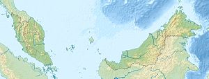
Kalampunian Island is the Malaysian state of Sabah owned island in the South China Sea off the northern tip of Borneo . The island is about 1.7 kilometers off Tanjung Simpang Mengayau , the northern tip of Borneo. Administratively it belongs to the Kudat district . The very small sandstone island rises steeply from the sea on an area of approx. 3,000 square meters. It is 100 meters long, 40 meters wide and up to 23 meters high. On the uninhabited island there is a 15 meter high red and white striped tower with a signal light. A reef that dries out at low tide and is almost a kilometer long extends southeast of the island. Pulau Kalampunian is accessible by a navigable canal about 300 meters wide from Tj. Simpang Mangayau separated.
Individual evidence
- ↑ Sailing Directions (Enroute) - Borneo, Jawa, Sulawesi and NUsa Tenggara (PDF; 5.8 MB), United States Navy Publication 163, sector 10, page 351, 2002; Accessed September 18, 2012
Remarks
- ↑ The values were approximately determined by evaluating the satellite image from google maps.

