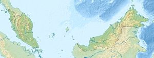
Pulau Tabawan
| Pulau Tabawan | ||
|---|---|---|
| Location of Pulau Tabawan in Darvel Bay | ||
| Waters | Celebes Sea | |
| Geographical location | 4 ° 47 '43 " N , 118 ° 22' 56" E | |
|
|
||
| length | 7 km | |
| width | 2.6 km | |
| Highest elevation | 275 m | |
Pulau Tabawan is an island belonging to Malaysia in Darvel Bay, which is open to the Celebes Sea . The island is about 60 kilometers east of Kunak. It is sometimes called Pearl Island because of its pearl farms . The name "Tabawan" comes from the Chinese language "大把 湾" and means "so many bays".
Pulau Tabawan is the largest of a densely forested group of islands in the southwest of Darvel Bay. It is easy to spot because of its 275 m high summit - the higher of two peaks of volcanic origin. Between two promontories in the south of the island there is a bay up to 36 m deep.
use
The island was for a long time inaccessible or very difficult to access because of the pearl farms located here. Scuba divers have only been allowed to visit the island for a few years.
To protect the island and the tourists - Pulau Tabawan is endangered by pirates because of the pearl farms - there is a permanently manned police station and a radar station on the island.
Web links
Individual evidence
- ↑ Sailing Directions (Enroute) - Borneo, Jawa, Sulawesi and Nusa Tenggara (PDF; 5.8 MB), United States Navy Publication 163, sector 10, page 287, 2002; Accessed August 24, 2012

