Pulau Si Amil
| Pulau Si Amil | ||
|---|---|---|
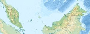
| Location of Pulau Si Amil in the Celebes Sea | ||
| Waters | Celebes Sea | |
| Geographical location | 4 ° 19 '50 " N , 118 ° 52' 20" E | |
|
|
||
| length | 1 km | |
| width | 900 m | |
| surface | 55 ha | |
| Highest elevation | 98 m | |
| Residents | uninhabited | |
Si Amil ( Mal. Pulau Si Amil ) is an island belonging to Malaysia in the Celebes Sea . It is located about 35 kilometers southeast of Semporna and 100 kilometers east of Tawau off the east coast of Borneo .
description
The approximately 0.55 square kilometer island extends over a length of one kilometer and is up to 900 meters wide. A steep hill 98 m high rises on the island, on which an 11 m high lighthouse was built in 1952. The forested island is uninhabited, but is populated by divers during the day. The Malaysian Navy also has a station on the island.
Pulau Si Amil belongs together with the islands of Pulau Danawan , Pulau Kapalai , Pulau Mabul , Pulau Ligitan and Pulau Sipadan to the so-called "Ligitan Group".
history
In 1918 the Japanese officer Lt. Col. Ichiji Orita the fishing grounds off Tawau. Orita, who was also closely associated with the Mitsubishi Group, founded the Borneo Fisheries Company in Tawau in 1927 and laid the foundation stone for a fish canning factory on Pulau Si Amil. The factory started with a workforce of 70 Japanese workers who processed the Ikan kayu , a local species of tuna. By the time the Japanese troops occupied Borneo, the number of people employed on the island had risen to 308. Today there are only remnants of the earlier factories on the island. Parts of the ruins are used by the naval base.
Diving
The wreck of an older steamship lies directly in front of the island. On the east side, the seabed drops to a depth of several hundred meters into the Alice Channel , which connects Darvel Bay with Sibuko Bay . The diving area is known, among other things, for the bamboo sharks , which usually appear at night .
literature
- Ken Goodlet: Tawau - The Making of a Tropical Community , Opus Publications, 2010 ISBN 978-983-3987-38-2
Web links
- Discovery Si Amil ; Accessed July 11, 2012
Individual evidence
- ↑ a b Sailing Directions (Enroute) - Borneo, Jawa, Sulawesi and Nusa Tenggara (PDF file; 5.49 MB), United States Navy Publication 163, sector 10, page 282, 2002; Accessed August 24, 2012
- ↑ Ligitan Coral Shelf - Diving Guide ( Memento of the original from November 29, 2014 in the Internet Archive ) Info: The archive link was automatically inserted and not yet checked. Please check the original and archive link according to the instructions and then remove this notice. (PDF file; 1.46 MB); Accessed July 12, 2012
- ↑ Goodlet, page 61
- ↑ Goodlet, p 103
- ↑ Si Amil Island ( Memento of the original from February 26, 2016 in the Internet Archive ) Info: The archive link was automatically inserted and not yet checked. Please check the original and archive link according to the instructions and then remove this notice. ; Accessed July 11, 2012
Remarks
- ↑ The values were approximately determined by evaluating the satellite image from google maps.

