Pulau Tambisan
| Pulau Tambisan | ||
|---|---|---|
| Waters | Sulu Lake | |
| Geographical location | 5 ° 28 '0 " N , 119 ° 7' 0" E | |
|
|
||
| length | 5.5 km | |
| width | 2.4 km | |
| surface | 14 km² | |
| Highest elevation | 21 m | |
| main place | Kg.Tambisan Laut | |
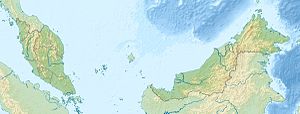
Tambisan Island is one to Malaysia is part of the island on the eastern edge of the Sulu Sea open Tangusa Bay . It is mostly densely forested. Its maximum length in east-west direction is approx. 9.5 km, the greatest width approx. 4 km. A narrow strait separates the island from the mainland. The island rises evenly 18–21 m from the sea; the treetops reach heights of up to 61 m.
history
The future head of state of Sabah, Sakaran Dandai worked from 1950 as an administrative clerk for the British government on Tambisan Island.
The current head of state of Sabah, Juhar Mahiruddin , was born in 1953 on Pulau Tambisan.
Pulau Tambisan Incident
Due to its exposed location on the eastern tip of Sabah, Tambisan is one of the islands of Sabah endangered by pirate attacks. In 1993, the so-called Pulau Tambisan incident occurred here, in which the 21st battalion of the Royal Malaysian Regiment was attacked by two speedboats manned by pirates and involved in a gun battle. The incident resulted in the deaths of two pirates and three injured.
Individual evidence
- ↑ Sailing Directions (Enroute) - Borneo, Jawa, Sulawesi and Nusa Tenggara (PDF file; 5.49 MB), United States Navy Publication 163, sector 10, page 286, 2002; Accessed August 24, 2012
- ↑ Government of Sabah: Biography of Tun Sakaran ; Accessed August 25, 2012
- ↑ 21st Royal Malay Regiment History ( Memento of the original from January 15, 2016 in the Internet Archive ) Info: The archive link was inserted automatically and has not yet been checked. Please check the original and archive link according to the instructions and then remove this notice. ; Accessed August 25, 2012
Remarks
- ↑ The values were approximately determined by evaluating the satellite image from google maps.
