Pulau Libaran
| Pulau Libaran | ||
|---|---|---|
| LANDSAT picture from 1990, with the Turtle Islands in the northeast and the coast of Borneo in the south | ||
| Waters | Sulu Lake | |
| Geographical location | 6 ° 6 '52 " N , 118 ° 1' 20" E | |
|
|
||
| length | 2.6 km | |
| width | 1 km | |
| surface | 2.19 km² | |
| Highest elevation | 16 m | |
| main place | Kampung Pulau Libaran | |
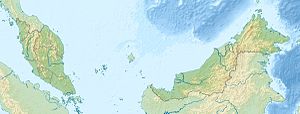
Pulau Libaran is an island belonging to the Malaysian state of Sabah in the Sulu Sea off the northeast coast of Borneo . The island is located 30 kilometers north of Sandakan and 5 kilometers northeast of the headland Tanjung Pisau, but only 3 kilometers southwest of the Turtle Islands ( Pulau Gulisaan ). The small island of Pulau Kawan is halfway between Pulau Libaran and Tanjung Pisau . Administratively it belongs to the Sandakan district . The island is flat and reaches a height of up to 16 meters. It is 2.6 kilometers long and one kilometer wide. Upstream to the east are three distinctive rocks, White Rock , Tree Rock and Black Rock .
The island is inhabited and has a police station, a school, a mosque, a post office, medical care and tourist accommodation ( Rumah Pelancongan Wildlife ).
Individual evidence
- ↑ Sailing Directions (Enroute) - Borneo, Jawa, Sulawesi and Nusa Tenggara (PDF; 5.8 MB), United States Navy Publication 163, sector 10, page 297, 2002; Accessed October 5, 2012
- ↑ Topographic Map 1: 100,000: Negeri Sabah Bahagian Sandakan Daerah Sandakan ; Edited by Jabatan Ukur & Permetaan Malaysia, 1st edition, 2008
Remarks
- ↑ The values were approximately determined by evaluating the satellite image from google maps.

