Pulau Banggi
| Pulau Banggi | ||
|---|---|---|
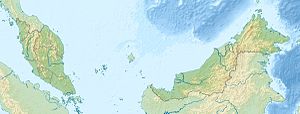
| Location of P. Banggi off the north coast of Sabah | ||
| Waters | South China Sea , Sulu Lake | |
| Geographical location | 7 ° 15 ' N , 117 ° 10' E | |
|
|
||
| surface | 441 km² | |
| Highest elevation | 529 m | |
| Residents | 20,000 45 inhabitants / km² |
|
| main place | Karakit | |
Banggi ( Malay : Pulau Banggi , sometimes also Bangi) is an island off the northern tip of Borneo belonging to the Malaysian state of Sabah . The island is administratively part of the Kudat District of the Kudat Division .
Banggi has an area of 441 km² and about 20,000 inhabitants, the highest point is 529 m. On the southern tip of the island is the small town of Karakit with a health center, mosque and an office of the forest administration. Approximately 24 hectares of the island were declared a protected area in 1984 (Class VI Virgin Jungle Reserve, VJR).
There are a number of other islets in the southeast. 5 km to the west is Pulau Balambangan , 15 km to the southeast Pulau Malawali .
Banggi located at the transition from the west of her lying South China Sea to the Sulu Sea in the east and connecting is on the north by the two seas Balabac Strait from the Philippine island of Balabac separately.

