Pulau Jambongan
| Pulau Jambongan | ||
|---|---|---|
| Jambongan Island from the ISS seen from | ||
| Waters | Sulu Lake | |
| Geographical location | 6 ° 41 ′ N , 117 ° 27 ′ E | |
|
|
||
| length | 20 km | |
| width | 14 km | |
| Highest elevation | Buli Gantungan 156 m |
|
| main place | Pekan Jambongan | |
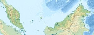
| Location of P. Jambongan off the north coast of Sabah | ||
Jambongan Island ( Engl. Jambongan Iceland ), sometimes Pulau Jembongan is too Sabah , Malaysia owned island in the Sulu Sea . It forms the eastern boundary of Paitan Bay and the northern boundary of Schomburgk Bay .
Pulau Jambongan is one of the largest islands in Sabah. In the southeast of the U-shaped island is the small town of Jambongan (also called Jembongan). The island is at its greatest extent 20 kilometers long and 14 kilometers wide. The island is separated from the mainland by an approx. 4 km wide water surface.
The east side of the island is lined with mangrove forests. Near Tanjong Landung Hayang , the northeasternmost point of the island, the shore is formed as a steep coast with a height of 52 m. South of the island is the mouth of the Sungai Paitan . The north coast between Tanjong Landung Taroh and Tanjong Buli Gantungan (northwest cliff ) drops 6 to 15 m steeply to the sea.
Between the 156 m high Tanjong Buli Gantungan (northwest cliff , 6 ° 44 'N., 117 ° 23' E.) and the 140 m high southwest cliff , ten kilometers away as the crow flies, there is a narrow bay that stretches for almost five kilometers in an east-southeast direction. The entrance to this bay is about three kilometers wide with a water depth of at least 3.7 m. The coastline of the bay is forested.
use
The island is heavily forested. Parts of the island are used for forestry. Part of the forest has been placed under protection by the Ministry of Forestry. The palm oil industry ( Asiatic Jambongan Estate Jambongan Island ), which had already settled on the island, was put under observation in order to prevent or mitigate harmful effects on the forests. The illegal logging on Jambongan Island poses a serious problem for the Ministry of Forestry, which is being countered with raids and the confiscation of large forestry machinery.
history
In the Mat Salleh rebellion in 1894, the island was the scene of the murder of two members of the Iban tribe, for which the chief Paduka Mat Salleh was held responsible. Captain Barnett and Barraut, who later became the district officer of Kudat, were assigned to capture Salleh in Jambongan, but were unsuccessful.
Individual evidence
- ↑ a b Sailing Directions (Enroute) - Borneo, Jawa, Sulawesi and NUsa Tenggara (PDF; 5.8 MB), United States Navy Publication 163, sector 10, page 298, 2002; Accessed August 24, 2012
- ↑ Forest Protection (PDF; 1.7 MB)
- ↑ Sabah Forestry Department: Enforcement & Investigation (PDF; 6.5 MB), Annual Report 2010


