Riesdorf (southern Anhalt)
|
Riesdorf
City of southern Anhalt
Coordinates: 51 ° 41 ′ 29 ″ N , 12 ° 6 ′ 38 ″ E
|
||
|---|---|---|
| Height : | 85 m above sea level NN | |
| Area : | 4.63 km² | |
| Residents : | 112 (Apr 13, 2016) | |
| Population density : | 24 inhabitants / km² | |
| Incorporation : | January 1, 2010 | |
| Postal code : | 06369 | |
| Area code : | 034978 | |
|
Location of Riesdorf in Saxony-Anhalt |
||
Riesdorf is a district of the city of Southern Anhalt in the Anhalt-Bitterfeld district in Saxony-Anhalt .
geography
The district of Riesdorf is bounded in the north by Körnitz, in the west by Cosa and Pösigk, in the east by Wehlau and Lennewitz and in the south by Weißandt-Gölzau .
history
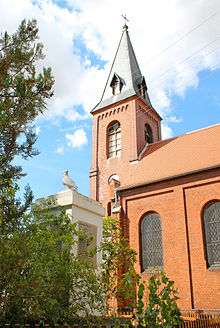
In 1268 Riesdorf was first mentioned in a document under the name Roidiersdorf . Several times over the centuries the church in Riesdorf had to be rebuilt.
Until the formation of the unitary community of Southern Anhalt on January 1, 2010, Riesdorf was an independent community in the administrative community of Southern Anhalt . The last mayor of Riesdorf was Olaf Behr.
Fire Brigade Museum
In the summer of 2000 the association Feuerwehrmuseum Riesdorf e. V. He collects historical evidence of the fire brigade as well as old materials and equipment and presents them to the public.


