Rimberg (Winterberg)
| Rimberg | ||
|---|---|---|
|
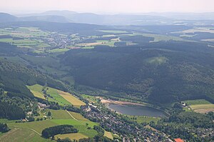
Aerial view: The Rimberg with Hillestausee and the Winterberg districts of Niedersfeld (front) and Grönebach (center left) |
||
| height | 764.6 m above sea level NHN | |
| location | near Niedersfeld ; Hochsauerlandkreis , North Rhine-Westphalia ( Germany ) | |
| Mountains | Rothaar Mountains | |
| Dominance | 1.13 km → southwest foot of Clemensberg | |
| Notch height | 94.2 m ↓ Scharte between Böhl and Ruhrkopf near the state road Küstelberg - B 480 (to Nordhelle or to Bremberg ) | |
| Coordinates | 51 ° 14 '48 " N , 8 ° 32' 16" E | |
|
|
||
| particularities | - Rimbergturm observation tower - transmission tower |
|

.
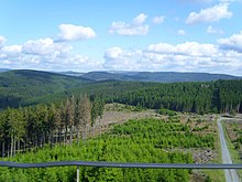
The Rimberg near Niedersfeld in the North Rhine-Westphalian Hochsauerlandkreis is 764.6 m above sea level. NHN high mountain in the Rothaar Mountains .
The mountain on which the currently closed Rimbergturm observation tower is located is a popular cross-country skiing area due to its 8 km long trail , which connects to the trails at Grönebach and Hildfeld .
geography
location
The Rimberg is located in the northeastern part of the Rothaargebirge in the Hochsauerland around 3.5 km west of the border to the northwestern part of Hesse and the Upland there . Its peak rises 1.7 km south-southeast of Niedersfeld , 1.9 km west-north-west of Hildfeld and 2.4 km (depending on the beeline ) north-north-west of Grönebach , three northern districts of Winterberg . The upper reaches of the Ruhr flow directly past the mountain in the west along the border with the Sauerland-Rothaargebirge nature park and the Hillebach in the east , where the Hillestausee lies north of the mountain and which flows into the Ruhr in Niedersfeld.
The neighboring mountains of the wooded Rimberg are Öhrenstein ( 792.1 m ) and Auf dem Sternrodt ( 789.4 m ) in the north (both on the other side of the Hilletal), Langenberg ( 843.2 m ) in the north-northeast, and Clemensberg (approx. 837 m ) in the east-northeast , Hillekopf ( 804.9 m ) in the east-southeast, Rimbergkopf ( 715.8 m ) and Auf der Hütte ( 714.8 m ) in the south (both Rimberg foothills) and on both sides of the Ruhr Valley Vossmeskopf ( 662.9 m ) in the south-south-west , Eschenberg ( 724.7 m ) in the west-southwest, Hoher Hagen ( 729 m ) in the west and Kahlenberg ( 732.8 m ) in the northwest.
Natural allocation
The Rimberg belongs to the natural spatial main unit group Süderbergland (No. 33), in the main unit Rothaargebirge (with Hochsauerland ) (333) and in the subunit Winterberger Hochland (333.5) to the natural area Nordheller Heights (333.57). The landscape falls to the east into the natural area of Harfeld (Winterberger Hochmulde) (333.56).
Mountain peaks and towers
The Rimberg summit ( 764.5 m ) is located around 20 m east of a trigonometric point at a height of 763 m .
A few meters south of the summit is the wooden Rimbergturm , a currently closed observation tower , from which there is otherwise a view of the Rothaargebirge. About 250 m north-north-west of the tower is a transmission tower at a height of around 705 m and a refuge just under 60 m southeast of it at around 730 m .
Protected areas
On parts of the Rimberg lies the Rimberg nature reserve ( CDDA no. 389872; designated 2008; 26 ha in size), to the west of the mountain is the Upper Ruhr Valley NSG (CDDA no. 389850; 2008; 55 ha ) with its fauna and flora habitat - Ruhr area (FFH no. 4614-303; 5.26 km² ) and to the east the NSG Irrgeister (CDDA no. 389797; 2008; 38 ha) with the FFH area Wiesen there in the Springebach and Hillebach valleys near Niedersfeld (FFH no . 4717-304; 1.16 km²). On the mountain there are parts of the landscape protection area part of the city of Winterberg (CDDA no. 325127; 1994; 75.32 km²).
Traffic and walking
Immediately past the Rimberg in the west along the Ruhr the federal highway 480 (Winterberg – Niedersfeld) and in the east along the Hillebach the state road 872 (Niedersfeld – Hildfeld). The mountain top can be reached on forest trails. The European long-distance hiking trail E1 runs through Niedersfeld and, part of the Ruhr valley, past the mountain to the west .
Individual evidence
- ↑ a b c d e Topographical Information Management, Cologne District Government, Department GEObasis NRW ( information )
- ↑ Martin Bürgener: Geographical Land Survey: The natural spatial units on sheet 111 Arolsen. Federal Institute for Regional Studies, Bad Godesberg 1963. → Online map (PDF; 4.1 MB)
- ↑ a b Map services of the Federal Agency for Nature Conservation ( information )

