San Miguel de Chaccrampa District
| San Miguel de Chaccrampa District | |
|---|---|
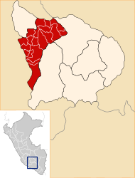
 The district of San Miguel de Chaccrampa is located in the southwest of the province of Andahuaylas (marked in red) |
|
| Basic data | |
| Country | Peru |
| region | Apurímac |
| province | Andahuaylas |
| Seat | San Miguel de Chaccrampa |
| surface | 84.9 km² |
| Residents | 1694 (2017) |
| density | 20 inhabitants per km² |
| founding | June 8, 1990 |
| ISO 3166-2 | PE-APU |
| politics | |
| Alcalde District | Pedro Nolasco Marcas Vargas (2019-2022) |
Coordinates: 13 ° 57 ′ 39 ″ S , 73 ° 36 ′ 27 ″ W.
The district of San Miguel de Chaccrampa (no longer current name: District of San Miguel de Chaccrapampa) is located in the province of Andahuaylas in the Apurímac region in the central south of Peru . The district was established on June 8, 1990. It has an area of 84.9 km². The 2017 census counted 1694 inhabitants. In 1993 the population was 1762, in 2007 it was 1850. The district administration is located in the 3650 m high village of San Miguel de Chaccrampa (also: Chaccrampa) with 662 inhabitants (as of 2017). San Miguel de Chaccrampa is 42 km southwest of the provincial capital Andahuaylas. Another larger place in the district is Iglesia Pata with 274 inhabitants.
Geographical location
The district of San Miguel de Chaccrampa is located in the Andean highlands in the southwest of the Andahuaylas province. The Río Chicha (also Río Soras) flows north along the western district boundary.
The district of San Miguel de Chaccrampa is bordered to the west by the districts of Paico and San Salvador de Quije (both in the province of Sucre ), to the north by the district of Chiara and to the east and south by the district of Huayana .
Web links
- Peru: Region Apurímac (provinces and districts) at www.citypopulation.de
- INEI Perú