Murowaniec hut
| Murowaniec hut (Polish: Schronisko PTTK Murowaniec) PTTK hut |
||
|---|---|---|
| location | In the valley Dolina Suchej Wody Gąsienicowej ; Poland | |
| Mountain range | High Tatras , Western Tatras | |
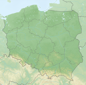
| Geographical location: | 49 ° 14 ′ 36 " N , 20 ° 0 ′ 26" E | |
| Altitude | 1500 m npm | |
|
|
||
| owner | PTTK | |
| Built | 1925 | |
| Construction type | Hut; stone | |
| Usual opening times | open all year | |
| accommodation | 120 beds, unknown | |
| Web link | Site of the hut | |
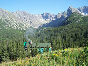
The Murowaniec hut ( pl. Schronisko PTTK Murowaniec ) is located at an altitude of 1500 m NPM in Poland at the boundary between the high Tatra and West Tatra in the valley Dolina Suchej Wody gąsienicowej on the Alm Hala Gąsienicowa . With 120 beds, the hut is the largest shelter in the Polish Tatras. The area belongs to the municipality of Zakopane .
history
The hut was built by the Polish army between 1921 and 1925 and opened by the then Polish President Stanisław Wojciechowski . 1951 to 1952 it was extended to the west wing. It was named after Adam Asnyk . The hut has been in the Tatra National Park since 1954 . It is owned by the PTTK .
Accesses
The hut can be reached:
- ▬ from the Zakopan district of Kuźnice via a blue hiking trail
- ▬ ▬ from the Zakopan district of Kuźnice via a yellow and later blue marked hiking trail
- ▬ from the Riegelscharte ( Zawrat ) on the Polish Black Lake via a blue-marked hiking trail
- ▬ from the panoramic road in Brzeziny via the milkweed alpine pasture ( Psia Trawka ) via a black marked hiking trail
- ▬ from the summit Wierchporoniec over the Alm Waksmunder Ebene , the Gänsehals mountain( Gęsia Szyja ) and the Alm Rusin-Wiese via a green hiking trail
- ▬ from the Kasprowy Wierch peakover the Roztoka Stawiańska plateau on a yellow-marked hiking trail
- ▬ of the mountain pass Kreuzsattel ( Krzyżne ) over the valley Pańszczyca valley on a yellow marked route
Transitions

Location of the mountain huts in the Tatra National Park
- ▬ ▬ To Meeraughütte ( 1,410 m ) above the valley Seealmtal the bar Charter ( Zawrat ) and continue over the Fünfseental over the blue marked trail and continue on the mountain pass copper saddle ( Szpiglasowa Przełęcz ) down into the Fish Lake Valley on a yellow marked trail
- ▬ To Five Polish Lakes hut ( 1671 m ) on the yellow-marked trail over the mountain pass Kreuzsattel ( Krzyżne )
- ▬ ▬ To the Roztoka Hut ( 1031 m ) via the yellow-marked hiking trail over the Krzyżne mountain passand then the green-marked hiking trail in the Roztoka Valley or ▬ ▬ via the green-marked hiking trail to the Waksmunder plateau and further along the red-marked hiking trail
- About the Zakopane area Kuźnice or the summit Kasprowy Wierch the mountain huts are Schronisko PTTK na Hali Kondratowej and Hotel górski PTTK Kalatówki in the Western Tatras accessible.
Tours

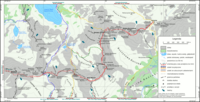
Map of the Orla Perć

Hala Gąsienicowa hut and alpine pasture in summer

Hala Gąsienicowa hut and alpine pasture in winter
Mountaineering
Summits in the vicinity of the hut are:
- The summit of the Orla Perć mountain trail
- Seealmspitze ( Świnica , 2301 m )
- Rear Polish Chapel ( Zadni Kościelec , 2162 m )
- Polish Chapel ( Kościelec , 2155 m )
- Lower Seealm Tower ( Zawratowa Turnia , 2246 m )
- Great Wallachian Head ( Wielki Wołoszyn , 2151 m )
- Little Wlachenkopf ( Mały Wołoszyn , 2145 m )
- Organ piper ( Wierch pod Fajki , 2135 m )
- Pańszczycka Tower ( Pańszczycka Turnia , 2105 m )
- Edge tower ( Skrajna Turnia , 2097 m )
- Yellow Mountain ( Żółta Turnia , 2087 m )
- Beskid ( 2012 m )
- Kasprowy Wierch ( 1987 m )
- Liliowa Kopka ( 1975 m )
- Uhrocie Kasprowe ( 1852 m )
- Małe Uhrocie Kasprowe ( 1753 m )
- Kopa Magury ( 1704 m )
- Mała Kopa Królowa ( 1577 m )
- Wielka Kopa Królowa ( 1531 m )
- Diabełek ( 1470 m )
- Skupniów Upłaz ( 1470 m )
- Mała Krokiew ( 1365 m )
- Wielki Copiesiec ( 1328 m )
- Kotlinowy Wierch ( 1305 m )
- Wysokie ( 1287 m )
- Łomik ( 1267 m )
- Mały Brilleiec ( 1167 m )
Mountain passes
- Riegelscharte ( Zawrat , 2158 m )
- Gemsenscharte ( Kozia Przełęcz , 2137 m )
- Kreuzsattel ( Krzyżne , 2112 m )
- Kerbsattel ( Karb , 1853 m )
Web links
Commons : Murowaniec hut - collection of images
literature
- Zofia Radwańska-Paryska, Witold Henryk Paryski, Wielka encyklopedia tatrzańska, Poronin, Wyd. Górskie, 2004, ISBN 83-7104-009-1 .
- Tatry Wysokie słowackie i polskie. Mapa turystyczna 1: 25.000, Warszawa, 2005/06, Polkart ISBN 83-87873-26-8 .


