Roztoka Hut
| Roztokahütte (Polish: Schronisko PTTK w Dolinie Roztoki) PTTK hut |
||
|---|---|---|
| location | In the Dolina Białki valley ; Poland | |
| Mountain range | High Tatras | |
| Geographical location: | 49 ° 14 '1 " N , 20 ° 5' 44" E | |
| Altitude | 1031 m npm | |
|
|
||
| owner | PTTK | |
| Built | 1876, 1913 | |
| Construction type | Hut; Stone, wood | |
| Usual opening times | open all year | |
| accommodation | 75 beds, unknown | |
| Web link | Site of the hut | |
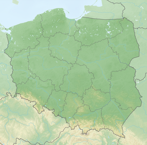
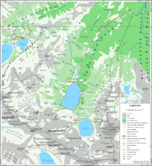
The Roztokahütte ( Polish Schronisko PTTK w Dolinie Roztoki ) is located at an altitude of 1031 m npm in Poland in the High Tatras in the Dolina Białki valley on the Stara Roztoka alpine pasture near the Dolina Roztoki valley . Contrary to its name, it is not located in the Dolina Roztoki valley. The area belongs to the Bukowina Tatrzańska commune , but the mountain hut has an address in Zakopane . In autumn, deer go to the pasture in front of the hut for the rut.
history
The first hut was built in 1876. The current hut was completed in 1913 and named after Wincenty Pol . The hut has been in the Tatra National Park since 1954 . At the beginning of the Second World War, it was used by Polish resistance fighters as a hostel and camp on the smuggling route to Slovakia and on to Hungary. It is owned by the PTTK .
Accesses
The hut is u. a. to reach:
- ▬ from the parking lots on the Łysa Polana and Palenica Białczańska pastures via a red marked hiking trail
- ▬ from the Meerauge mountain lakevia Toporowa Cyrhla , Psia Trawka and Rówień Waksmundzka via a red marked hiking trail
- ▬ from the Dolina Roztoki and Dolina Pięciu Stawów Polskich valleysvia a green marked hiking trail thatbeginsnear the Wodogrzmoty Mickiewicza waterfall
Transitions

- ▬ To the Murowaniec hut ( 1500 m ) via the green marked hiking trail in the Dolina Roztoki valleyand further on the blue marked hiking trail in the Dolina Pięciu Stawów Polskich valleyand the yellow marked hiking trail over the Krzyżne mountain passdown into the Dolina Suchej Wody valley
- ▬ To the Five Polish Lakes Hut ( 1671 m ) via the green hiking trail in the Dolina Roztoki valley
- ▬ To the Meeraughütte ( 1410 m ) via the red marked hiking trail in the Dolina Rybiego Potoku valley
Tours
Mountaineering
Summits in the vicinity of the hut are:
- Rysy ( 2499 m )
- Niżnie Rysy ( 2430 m )
- Orla Perć via ferrata peak ( 2301 m )
- Żabi Szczyt Wyżni ( 2259 m )
- Spadowa Kopa ( 2251 m )
- Miedziane ( 2233 m )
- Wielka Koszysta ( 2193 m )
- Waksmundzki Wierch ( 2186 m )
- Wielka Buczynowa Turnia ( 2184 m )
- Wielki Wołoszyn ( 2155 m )
- Żabi Mnich ( 2146 m )
- Mały Wołoszyn ( 2144 m )
- Pośredni Wołoszyn ( 2117 m )
- Żabi Szczyt Niżni ( 2098 m )
- Skrajny Wołoszyn ( 2092 m )
- Żabia Czuba ( 2079 m )
- Marusarzowa Turnia ( 2075 m )
- Bula pod Rysami ( 2054 m )
- Owcze Turniczki ( 2040 m )
- Wierch nad Zagonnym Żlebem ( 2039 m )
- Opalony Wierch ( 2015 m )
- Mała Koszysta ( 2014 m )
- Siedem Granatów ( 1915 m )
- Turnia nad Dziadem ( 1901 m )
- Niedźwiedź ( 1812 m )
- Świstowa Czuba ( 1763 m )
- Turnia nad Szczotami ( 1741 m )
- Czuba nad Uboczą ( 1630 m )
- Roztocka Turniczka ( 1536 m )
- Gęsia Szyja ( 1489 m )
- Suchy Wierch Waksmundzki ( 1485 m )
- Ostry Wierch Waksmundzki ( 1475 m )
- Łężny Wierch ( 1246 m )
- Filipczański Wierch ( 1223 m )
water falls
- Wodogrzmoty Mickiewicza (10 m)
- Siklawa (80 m)
Web links
literature
- Zofia Radwańska-Paryska, Witold Henryk Paryski: Wielka encyklopedia tatrzańska. Poronin, Wyd. Górskie, 2004, ISBN 83-7104-009-1 .
- Tatry Wysokie słowackie i polskie. Mapa turystyczna 1: 25000, Warszawa, 2005/06, Polkart ISBN 83-87873-26-8 .


