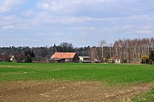
Senftenhütte
|
Senftenhütte
Chorin parish
Coordinates: 52 ° 55 ′ 48 ″ N , 13 ° 51 ′ 37 ″ E
|
|
|---|---|
| Height : | 72 m above sea level NHN |
| Area : | 1.74 km² |
| Residents : | 181 (December 31, 2006) |
| Population density : | 104 inhabitants / km² |
| Incorporation : | September 27, 1998 |
| Postal code : | 16230 |
| Area code : | 033364 |
|
Senftenhütte village church
|
|
Senftenhütte is a district of the official municipality Chorin in the Barnim district in Brandenburg . Until it was incorporated on September 27, 1998, Senftenhütte was an independent municipality administered by the Britz-Chorin office.
location
Senftenhütte is located in the Schorfheide-Chorin Biosphere Reserve , about twelve kilometers as the crow flies north of the district town of Eberswalde and southwest of the city of Angermünde . Surrounding villages are of the community Ziethen belonging district Gross-Ziethen in the Northeast, Buchholz and Serwest the east, the south Chorin, Golzow in the southwest and Althüttendorf in the northwest.
The place is at the end of the district road 6015, which leads to Althüttendorf. The federal highway 198 from Althüttendorf to Angermünde runs about two kilometers north of Senftenhütte. The federal motorway 11 runs near the village , the closest junction to Joachimsthal is about four kilometers away. Immediately to the south, the Berlin – Stettin line runs past Senftenhütte; the nearest train station is in Golzow.
history
The round village Senftenhütte was first mentioned as a village in 1784. However, the date of establishment of the place is January 1, 1706, when the lease agreement for the glassworks that was then built on the current location was concluded. The glassworks initially belonged to the businessman Christian Puhlmann from Berlin , in 1718 the glassworks was taken over by a new lessee named Johann Georg Senff. The place name is derived from this.
In 1841, 383 people lived in 46 residential buildings in Senftenhütte . The village church was a branch church of the church in Herzsprung near Angermünde. At that time Senftenhütte belonged to the city of Neustadt-Eberswalde , today's Eberswalde . During the GDR era, the station for the number transmitter Gong was located in a wooded area near Senftenhütte .
Senftenhütte has always been a Prussian village and initially belonged to the Stolpirische Kreis . From April 1, 1817, the place was in the Angermünde district of the administrative district of Potsdam in the province of Brandenburg . On September 30, 1928, the Senftenthal forestry district was dissolved and incorporated into Senftenhütte. After the Second World War, the community became part of the Soviet occupation zone and later the GDR . During the territorial reform carried out in the GDR in July 1952, the Senftenhütte community was assigned to the Eberswalde district in the Frankfurt (Oder) district . After the reunification , the Eberswalde district was renamed the Eberswalde district and finally dissolved. During the district reform in December 1993 , the Senftenhütte community was assigned to the new Barnim district , where it was co-administered by the Britz-Chorin office . On 27 September 1998, the municipality Senft hut was dissolved and the place together with the hitherto also independent communities Golzow, New house and Sandkrug by Chorin incorporated. In 2008 the Britz-Chorin office was renamed to Britz-Chorin-Oderberg office.
Monuments
For the village of Senftenhütte, two architectural monuments are shown in the list of monuments of the state of Brandenburg . These are:
- the forester's house Senftenthal
- the village church Senftenhütte . The construction of the church began in 1803, the nave was completed in 1806 or 1807. The building is a massive field stone and split stone masonry construction with a hipped roof . The church was initially built without a steeple , presumably for lack of money . The square brick west tower with a tent roof was added in 1931. Inside the church has a coffered wooden ceiling and a west gallery .
Population development
| Population development in Senftenhütte from 1875 to 1996 | |||||||||||||||||||
|---|---|---|---|---|---|---|---|---|---|---|---|---|---|---|---|---|---|---|---|
| year | Residents | year | Residents | year | Residents | ||||||||||||||
| 1875 | 573 | 1939 | 392 | 1981 | 220 | ||||||||||||||
| 1890 | 519 | 1946 | 509 | 1985 | 191 | ||||||||||||||
| 1910 | 444 | 1950 | 485 | 1989 | 183 | ||||||||||||||
| 1925 | 403 | 1964 | 344 | 1992 | 186 | ||||||||||||||
| 1933 | 397 | 1971 | 300 | 1996 | 197 | ||||||||||||||
Web links
Individual evidence
- ↑ Community and district directory. In: geobasis-bb.de. Land surveying and geographic base information Brandenburg, accessed on July 26, 2018 .
- ↑ Reinhard E. Fischer : The place names of the states of Brandenburg and Berlin. Age - origin - meaning . be.bra Wissenschaft, Berlin 2005, p. 158 .
- ↑ Topographical and statistical overview of the administrative district of Potsdam and the city of Berlin . Verlag der Gander'schen Buchhandlung, Berlin 1841, p. 249 ( zlb.de ).
- ↑ Senftenhütte in the historical directory. Retrieved July 26, 2018 .
- ↑ List of monuments of the State of Brandenburg: District Barnim (PDF) Brandenburg State Office for Monument Preservation and State Archaeological Museum, accessed on July 26, 2018
- ↑ Entry in the monument database of the State of Brandenburg , accessed on July 26, 2018.
- ↑ The Church. In: senftenhuette.de. Retrieved July 26, 2018 .
- ^ Gerhard Vinken, Barbara Rimpel et al. (Arrangement): Dehio-Handbuch der Deutschen Kunstdenkmäler, Brandenburg. 2nd edition, Deutscher Kunstverlag, Munich / Berlin 2012, ISBN 978-3-422-03123-4 , pp. 1051-1052.
- ^ Historical municipality register of the state of Brandenburg 1875 to 2005. (PDF; 381 KB) District Barnim. State Office for Data Processing and Statistics State of Brandenburg, December 2006, accessed on July 26, 2018 .

