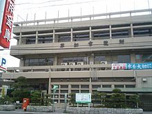
Sōka
| Sōka-shi 草 加 市 |
||
|---|---|---|
| Geographical location in Japan | ||
|
|
||
| Region : | Kanto | |
| Prefecture : | Saitama | |
| Coordinates : | 35 ° 50 ′ N , 139 ° 48 ′ E | |
| Basic data | ||
| Surface: | 27.42 km² | |
| Residents : | 250,939 (October 1, 2019) |
|
| Population density : | 9152 inhabitants per km² | |
| Community key : | 11221-6 | |
| Symbols | ||
| Flag / coat of arms: | ||
| Tree : | jaw | |
| Flower : | Garden chrysanthemum | |
| town hall | ||
| Address : |
Sōka City Hall 1 - 1 - 1 , Takasago Sōka -shi Saitama 340-8550 |
|
| Website URL: | http://www.city.soka.saitama.jp | |
| Location of Sōkas in Saitama Prefecture | ||
Sōka ( Japanese 草 加 市 , -shi ) is a city in the southeast of Saitama Prefecture . The city is famous for Sōka- Senbei .
geography
Sōka is west of Yashio , east of Kawaguchi , south of Koshigaya and north of Tokyo .
history
- In the Edo period, Sōka was the second post station on the Ōshū Kaidō towards Nikkō and northern Japan.
- Sōka got on 1. November 1958 , the city charter .
Facilities
Sōka is the seat of the Dokkyō University .
traffic
- Street:
- National road 4 to Tōkyō or Aomori
- Train:
- Tōbu Isesaki Line to Asakusa or Isesaki
- Tōbu Nikkō line to Asakusa or Nikkō
Town twinning
-
 Carson , United States, since 1979
 -
 Shōwa , Japan, since 1985
 -
 Anyang , People's Republic of China, since 1998
sons and daughters of the town
- Youko Honna (* 1979), actress and voice actress
- Hiroto Yukie (born 1996), soccer player
Neighboring cities and communities
Web links
Commons : Sōka - collection of images, videos and audio files


