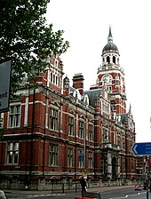
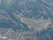
London Borough of Croydon
| London Borough of Croydon | |
|---|---|
| status | London Borough |
| region | Greater London |
| Administrative headquarters | Croydon |
| surface | 86.52 km² |
| Residents | 385,346 |
| was standing | 2018 |
| ONS code | 00AH |
| Website | www.croydon.gov.uk |
The London Borough of Croydon [ kɹɔɪdn ] is a borough of London .
description
The London Borough of Croydon is located in the south of London , is the most populous of all boroughs and has grown into a major business center. When the Greater London administrative region was founded in 1965, the district emerged from the County Borough of Croydon and the Coulsdon and Purley Urban District in the county of Surrey .
The population in 2011 was composed of 55.1% white, 16.4% Asian, 20.2% black and 8.3% other.
Croydon has traditionally been a major industrial location and in some ways has also played a pioneering role in the development of London's transport system.
history
Croydon became a center of production during the Middle Ages. Here charcoal burners , tanneries and breweries were active. In the early 20th century, Croydon was an important industrial area for metal working. Gillett & Johnston was a bell foundry and tower clock manufacturer for over 100 years . The company Trojan Limited built from about 1920 cars.
Districts
- Addington
- Addiscombe
- Broad Green
- Coombe
- Coulsdon
- Croydon
- Crystal Palace
- Forestdale
- Hamsey Green
- Kenley
- Monks Orchard
- New Addington
- Norbury
- Norwood New Town
- Old Coulsdon
- Pollards Hill
- Purley
- Sanderstead
- Selhurst
- Selsdon
- Shirley
- South Croydon
- South Norwood
- Thornton Heath
- Upper Norwood
- Upper Shirley
- Waddon
- Woodcote
- Woodside
- Whyteleafe
traffic
In 1803 the Surrey Iron Railway was opened to Wandsworth , the first (horse-drawn) public railway line in the world. In the 19th century, Croydon was connected to the Brighton Main Line of the Southern Railway with East Croydon and South Croydon stations . On October 24, 1947, a rear-end collision between two suburban trains occurred in the southern entrance of the South Croydon station after the illegal intervention of an interlocking employee in fog. 32 people died, 142 were also injured. This was the worst accident that ever happened on the Southern Railway.
From 1920 to 1959, Croydon Airport , the main airport of London, was in the urban area , which was replaced by London Heathrow Airport and London Gatwick Airport . The Croydon Tramlink tram system opened in 2000 , 48 years after the last tram line in London closed. The Borough of Croydon has around 120 parks and public spaces that cover around 17.5 km².
Personalities
The following personalities are associated with Croydon in one way or another. The high proportion of musicians and actors is explained by the fact that the BRIT School for Performing Arts & Technology is located in Croydon.
- Peggy Ashcroft (1907-1991), actress
- Lionel Atwill (1885-1946), actor
- Herbert Beer (1914–1971), politician
- Benga (DJ) (* 1986), DJ and producer
- Derren Brown (* 1971), illusionist
- Peter Brunt (1917–2005), historian
- Anne Clark (* 1960), musician
- Brian Clemens (1931-2015), film producer
- Ian Cox (born 1971), football player
- Peter Cushing (1913–1994), actor
- Tracey Emin (* 1963), artist
- Bernard Fagg (1915–1987), archaeologist
- Mickey Finn (1947-2003), musician
- Matthew Fisher (born 1946), musician
- Jessie Gilbert (1987-2006), chess master
- Trevor Goddard (1962-2003), actor
- Tommy Hall (1877-1949), cyclist
- Roy Hodgson (* 1947), football coach
- Les Humphries (1940-2007), pop musician
- Oliver Jones (* 1986), musician
- David Lean (1908-1991), film director
- Peter Ling (1926–2006), journalist and writer
- M (* 1947), singer
- Kirsty MacColl (1959-2000), singer
- Katie Melua (* 1984), singer
- Kate Moss (born 1974), model
- Rosemary Neering (* 1945), journalist and writer
- Dickie Pride (1941-1969), musician
- Ronald C. Read (1924–2019), British-Canadian mathematician
- John Ruskin (1819–1900), writer and social reformer
- Nicholas Soames (* 1948), politician
- Dan Stevens (born 1982), actor
- Sam Taylor-Johnson (* 1967), film director
- Beni Uthman (* 1986), musician
- Aaron Wan-Bissaka (born 1997), football player
- Sophie Wilcox (* 1975), actress
- Edward Woodward (1930–2009), actor
Web links
- London Borough of Croydon (county council)
Individual evidence
- ↑ Mid 2018 Estimates of the population for the UK, England and Wales, Scotland and Northern Ireland
- ↑ Ethnic Group by measures 2011 census. Office for National Statistics, accessed August 5, 2018 .
- ↑ www.gillettjohnston.co.uk , see also English Wikipedia
Coordinates: 51 ° 22 ′ N , 0 ° 6 ′ W


