
St. Bernhard (Thuringia)
| coat of arms | Germany map | |
|---|---|---|

|
Coordinates: 50 ° 28 ' N , 10 ° 36' E |
|
| Basic data | ||
| State : | Thuringia | |
| County : | Hildburghausen | |
| Management Community : | Field stone | |
| Height : | 480 m above sea level NHN | |
| Area : | 7.36 km 2 | |
| Residents: | 256 (Dec. 31, 2019) | |
| Population density : | 35 inhabitants per km 2 | |
| Postal code : | 98660 | |
| Area code : | 036873 | |
| License plate : | HBN | |
| Community key : | 16 0 69 047 | |
| Association administration address: | Mauerstraße 9 98660 Themar |
|
| Mayor : | Dieter Leffler (independent) | |
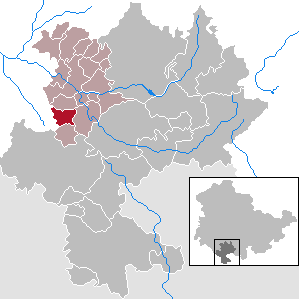
| Location of the municipality of St. Bernhard (Thuringia) in the Hildburghausen district | ||
  |
||

St. Bernhard is a municipality in the district of Hildburghausen in the Franconian south of the Free State of Thuringia . The community belongs to the administrative community Feldstein . The administrative seat is in the city of Themar .
geography
St. Bernhard is located south of Beinerstadt on the St. Bernhard shell limestone plateau on stony and barren soil. The altitude above sea level varies between 380 and 470 meters. It's not far to the border between Bavaria and Thuringia.

history
The village was first mentioned on May 25, 956. During the time of the tribal duchies, the place was in the Duchy of Franconia . In terms of lordship, the place in the Themar office initially belonged to the county of Henneberg , after 1583 to various Saxon duchies and from 1826 to 1918 to Saxony-Meiningen . In 1920 he came to the state of Thuringia .
Municipal council
The parish council in St. Bernhard consists of six council members:
- SV 84: 2 seats
- Fire Brigade Association: 2 seats
- Free voters: 2 seats
(As of: local elections on May 25, 2014)
Attractions
The Evangelical Lutheran Church of St. Martin was built between 1842 and 1844.
Economy and Infrastructure
The place is predominantly agricultural. The Landgenossenschaft Goldene Ähre Beinerstadt is an employer for several residents of the community.
Individual evidence
- ^ Population of the municipalities from the Thuringian State Office for Statistics ( help on this ).
- ^ Wolfgang Kahl: First mention of Thuringian towns and villages. A manual. Rockstuhl Publishing House, Bad Langensalza 2010, ISBN 978-3-86777-202-0 , p. 270.
- ↑ Verwaltungsgemeinschaft Feldstein , accessed on March 15, 2014
Web links
Ahlstädt | Floodplain | Beinerstadt | Bischofrod | Brno / Thür. | Thing life | Ehrenberg | Eichenberg | Ice field | Grimmelshausen | Grub | Heldburg | Henfstädt | Hildburghausen | Veßra Monastery | Lengfeld | Marisfeld | Masserberg | Upper Town | Reurieth | Römhild | Bad type | Lock bottom | Schleusingen | Schmeheim | Schweickershausen | St. Bernhard | Straufhain | Themar | Ummerstadt | Veilsdorf | Westhausen