
Henfstädt
| coat of arms | Germany map | |
|---|---|---|
 Help on coat of arms |
Coordinates: 50 ° 31 ' N , 10 ° 35' E |
|
| Basic data | ||
| State : | Thuringia | |
| County : | Hildburghausen | |
| Management Community : | Field stone | |
| Height : | 330 m above sea level NHN | |
| Area : | 8.13 km 2 | |
| Residents: | 375 (Dec. 31, 2019) | |
| Population density : | 46 inhabitants per km 2 | |
| Postal code : | 98660 | |
| Area code : | 036873 | |
| License plate : | HBN | |
| Community key : | 16 0 69 021 | |
| Association administration address: | Mauerstr. 9 98660 Themar |
|
| Website : | ||
| Mayoress : | Simone Langner-Schneider (independent) | |
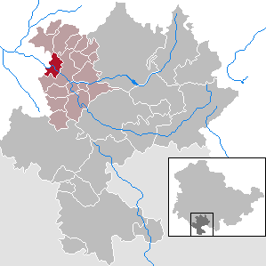
| Location of the municipality of Henfstädt in the Hildburghausen district | ||
  |
||

Henfstädt is a municipality in the Hildburghausen district in the Franconian south of Thuringia. She belongs to the administrative community Feldstein . The administrative seat is in the city of Themar .
geography
Henfstädt lies in the Werra valley between Themar and Leutersdorf, for the most part on the left bank of the river.
Neighboring communities
Neighboring communities are (clockwise) Marisfeld , Oberstadt , Themar and Leutersdorf .
Waters and springs
The Werra flows past the municipality in the north. Above the village in the direction of Themar, the Tachbach coming from the north flows into the Werra. Shortly before Henfstädt, between the B 89 and the Werra Railway, there is a shallow lake completely covered with trees. To the northwest of Henfstädt there is a rock bar that stretches through the entire Werra valley and was broken through in the middle by the Werra in prehistoric times. This breakthrough is called the eye of the needle. During the construction of the Werra Railway, the river near the eye of the needle was straightened so that an oxbow lake was created. The current course of the river is on the left side of the Werra valley and no longer in its center. To the west of this straightening is the Burkhardtsquelle in direct proximity to the Werra. Another, smaller spring, the Ottilien spring, is located south of Henfstädt near the Steinhauck desert on the Steinernen Berg.
Mountains and heights
To the left of the Werra are (downstream) the Steinerne Berg (499 m), which is separated from the Wachental by the Gebirgsleite, the Sielleite, the Dellesberg and the Rappelsberg. To the right of the Werra are the Kleine Spielberg (375 m), the Hain above the Buhleite and the Gertleser Höhe (465 m) above the Stickeleite steep slope.
history

The place was first mentioned in 914 under the name Henfestadt in a document that goes back to an exchange contract of possessions between the abbot Huggi and the noble Gunter. However, there are traces of a much earlier settlement in the municipality.
Early history
The right bank of the Werra near Henfstädt was already settled in the Mesolithic , as more than 300 finds prove. During the construction of the half-barrier at the level crossing in the direction of Tachbach , a grave with grave goods was found on the Strick corridor in 1970, which was dated to the 6th century BC. It contained a richly adorned corpse of a woman who probably belonged to a higher class. The Strick was continuously populated from the Urnfields until the 3rd century AD.
Middle Ages and Early Modern Times

In the Middle Ages, many noble families settled in Henfstädt (including those of Bräuning, Kießling, Herbilstadt , Bibra , Zufraß, Obernitz and Hanstein ), including the three aristocratic estates, the ruins of the Osterburg and the grave slabs of the nobles in the church and in the cemetery witness (see below).
From 1612 to 1629 there were witch hunts in Henfstädt . Five women got into witch trials , one was burned. Margaretha Götze, 70 years old, made several suicide attempts before she died under torture.
In terms of lordship, the place in the Themar office initially belonged to the county of Henneberg , after 1583 to various Saxon duchies and from 1826 to 1918 to Saxony-Meiningen . In 1920 he came to the state of Thuringia .
Desolation
There are three in the proximity of Henfstädt deserted villages . The desert of Gertles lies above the Werra valley in the direction of Marisfeld and Oberstadt. The second deserted area, Steinhaug , is located in the vicinity of the ruin "Steinerne Kirche" and the Ottilien spring. It was mentioned in a document as early as 890. The location of the third desert with the name Berthuns is no longer known.
Municipal council
The municipal council in Henfstädt consists of six council members:
- Free voters 4 seats
- Fire Brigade Association 1 seat
- Bowling club 1 seat
(As of: local elections on June 7, 2009)
Culture and sights
Buildings


- Osterburg , a ruined castle that is completely surrounded by a rampart and moat
- Castle, formerly part of the Obernitzian estate, also called the front castle
- Medium estate, originally a Henneberg manor
- Rear castle , as part of the zuraßischen estate (later Hanstein and Harbou)
- Village church , first mentioned in 1544 as a daughter church of Leutersdorf
- Cemetery chapel, built in 1585
- Rectory with the Heimatstube and the library
- Werra Valley Bridge, built around 1857
Freetime activities
The paved Werratal cycle path runs through Henfstädt . There is a canoe rental with a beer garden right on the bike path .
Personalities
The author and doctor Hieronymus Hornschuch (1573–1616) was born in 1573 in Henfstädt.
Individual evidence
- ^ Population of the municipalities from the Thuringian State Office for Statistics ( help on this ).
- ↑ http://www.rhoen.info/lexikon/staetten/Siedlungsspuren_der_Vorgeschichte_bei_Henfst%E4dt_5269352.html
- ↑ http://www.rhoen.info/cgi-bin/WebObjects/Portal.woa/wa/Gate/RLRealzeugnisseDetail?objectID=5269528
- ^ A b Georg Brückner : Regional studies of the Duchy of Meiningen. Second part: the topography of the country . Verlag von Brückner and Renner, Meiningen 1853, pp. 251-254.
- ^ Kai Lehmann : Exhibition "Luther and the Witches", Henfstädt area , Library Museum Schloss Wilhelmsburg Schmalkalden, 2012; Ronald Füssel: The persecution of witches in the Thuringian region (= publications of the working group for historical witchcraft and crime research in Northern Germany , Volume 2), Hamburg 2003, p. 247.
Web links
Ahlstädt | Floodplain | Beinerstadt | Bischofrod | Brno / Thür. | Thing life | Ehrenberg | Eichenberg | Ice field | Grimmelshausen | Grub | Heldburg | Henfstädt | Hildburghausen | Veßra Monastery | Lengfeld | Marisfeld | Masserberg | Upper Town | Reurieth | Römhild | Bad type | Lock bottom | Schleusingen | Schmeheim | Schweickershausen | St. Bernhard | Straufhain | Themar | Ummerstadt | Veilsdorf | Westhausen