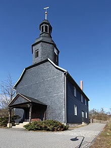
Bischofrod
| coat of arms | Germany map | |
|---|---|---|

|
Coordinates: 50 ° 32 ' N , 10 ° 40' E |
|
| Basic data | ||
| State : | Thuringia | |
| County : | Hildburghausen | |
| Management Community : | Field stone | |
| Height : | 390 m above sea level NHN | |
| Area : | 5.47 km 2 | |
| Residents: | 161 (Dec. 31, 2019) | |
| Population density : | 29 inhabitants per km 2 | |
| Postal code : | 98553 | |
| Area code : | 036873 | |
| License plate : | HBN | |
| Community key : | 16 0 69 004 | |
| LOCODE : | DE 6BP | |
| Association administration address: | Mauerstr. 9 98660 Themar |
|
| Mayoress : | Bianka Kühm-Pankow (independent) | |
| Location of the community of Bischofrod in the Hildburghausen district | ||
Bischofrod is a municipality in the district of Hildburghausen in the Franconian south of the Free State of Thuringia . Keulrod also belongs to the community . Bischofrod is administered by the Feldstein administrative community.
location
Bischofrod is located on the southern roof of the Thuringian Forest in the western area of the federal motorway 73 south of Suhl . The mountain village is affected by the state roads 2633 and 2634.
history
The village was first mentioned on March 30, 1262.
Bischofrod was persecuted by witches from 1604 to 1618. Three women got into witch trials . A trial outcome is unknown, a woman was burned. In 1618 Ursula Geißenhämmer had “shown unchristian and defiant” under severe torture and made no confession. She was released.
Until 1815, Bischofrod belonged to the Henneberg or Electoral Saxon office of Schleusingen and then came to the Schleusingen district of the newly formed Prussian province of Saxony , where he remained until 1945.
Municipal council
The municipal council of Bischofrod consists of six members of a free voter community (status: local election on May 25, 2014 ).
Individual evidence
- ^ Population of the municipalities from the Thuringian State Office for Statistics ( help on this ).
- ^ Wolfgang Kahl: First mention of Thuringian towns and villages. A manual. Rockstuhl Verlag, Bad Langensalza, 2010, ISBN 978-3-86777-202-0 , p. 34
- ^ Kai Lehmann : Exhibition "Luther and the Witches", Bischofrod area, Library Museum Schloss Wilhelmsburg Schmalkalden, 2012; Manfred Wilde : The sorcery and witch trials in Kursachsen , Cologne, Weimar, Vienna 2003, pp. 568–592; Ronald Füssel: The persecution of witches in the Thuringian region , publications of the working group for historical witchcraft and crime research in Northern Germany, Volume 2, Hamburg 2003, p. 244f. and 253f.
- ^ Michael Rademacher: German administrative history from the unification of the empire in 1871 to the reunification in 1990. Schleusingen district. (Online material for the dissertation, Osnabrück 2006).


