
Upper Town
| coat of arms | Germany map | |
|---|---|---|
 Help on coat of arms |
Coordinates: 50 ° 33 ' N , 10 ° 36' E |
|
| Basic data | ||
| State : | Thuringia | |
| County : | Hildburghausen | |
| Management Community : | Field stone | |
| Height : | 430 m above sea level NHN | |
| Area : | 13.4 km 2 | |
| Residents: | 336 (Dec. 31, 2019) | |
| Population density : | 25 inhabitants per km 2 | |
| Postal code : | 98530 | |
| Area code : | 036846 | |
| License plate : | HBN | |
| Community key : | 16 0 69 035 | |
| Address of the municipal administration: |
Main street 35 98530 Upper Town |
|
| Mayor : | Andreas Oertel (FFw) | |
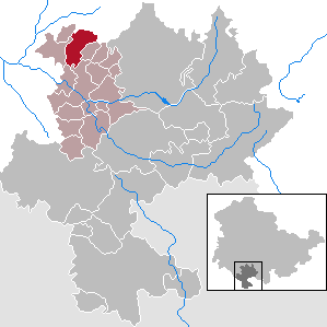
| Location of the municipality of Oberstadt in the Hildburghausen district | ||
  |
||

Oberstadt is a municipality in the district of Hildburghausen in the Franconian south of Thuringia . She belongs to the administrative community Feldstein . The administrative seat is in the city of Themar .
location
Oberstadt is located on the country road 2633 from Grub to Marisfeld and at the foot of the southern roof of the Thuringian Forest towards Themar . Over half of the corridor is forested and is part of the Thuringian Forest. The other half is favorably influenced by the Schweinfurt climate area. Landesstraße 2628 runs south.


history
The place was first mentioned in a document in 1317. In terms of lordship, the place in the Themar office initially belonged to the county of Henneberg , after 1583 to various Saxon duchies and from 1826 to 1918 to Saxony-Meiningen . In 1920 he came to the state of Thuringia .
buildings
church
The first church is documented for 1380. There was a follow-up building in 1608. This was destroyed by fire in 1885. The current, neo-Gothic church was consecrated in 1887.
Moated castle
In 1380 the Counts of Henneberg gave the moated castle as a fief to the Lords of Kießling . In 1397 the castle was destroyed as a robbery. The bower is still preserved. In 1469 the Marschalk von Ostheim followed and in 1606 the Henneberg supervisor Humpert von Langen . In the 15th and 16th centuries the bower was expanded to become a moated castle and in 1607 it was transformed into the current moated castle. Johann Georg von Langen was born here in 1699. In 1712 the Austrian Spiller von Mitterberg, 1782 von Seebach and then von Bünau are registered as owners. After several changes of ownership, the castle belonged to Herr von Eichel auf Marisfeld from 1892 . After 1990 it was extensively renovated by the buyer Bernd Fleckenstein, who sold it to the Saupe family in 2015.
Municipal council
The municipality council in Oberstadt consists of six council members:
- Volunteer fire brigade 4 seats
- Free voters 1 seat
- Culture and local history association 1 seat
(As of: local elections on June 7, 2009)
Sons and daughters of the church
- Johann Georg von Langen (born March 22, 1699 - † May 25, 1776 in Jægersborg near Copenhagen ), master forestry and chief hunter
Web links
Individual evidence
- ^ Population of the municipalities from the Thuringian State Office for Statistics ( help on this ).
- ^ Wolfgang Kahl: First mention of Thuringian towns and villages. A manual. Rockstuhl Verlag, Bad Langensalza, 2010, ISBN 978-3-86777-202-0 , p. 210
- ^ Joachim Neubert, Günter Stammberger, Bernhard Grossmann, Martin Hoffmann: The churches in the district of Hildburghausen . Verlag Frankenschwelle, Hildburghausen 2006, ISBN 3-86180-174-4 , p. 204
- ↑ Michael Köhler: Thuringian castles and fortified prehistoric and early historical living spaces. Jenzig-Verlag, 2001, ISBN 3-910141-43-9 , p. 195
- ↑ Wochenspiegel Thuringia from January 26, 2015
Ahlstädt | Floodplain | Beinerstadt | Bischofrod | Brno / Thür. | Thing life | Ehrenberg | Eichenberg | Ice field | Grimmelshausen | Grub | Heldburg | Henfstädt | Hildburghausen | Veßra Monastery | Lengfeld | Marisfeld | Masserberg | Upper Town | Reurieth | Römhild | Bad type | Lock bottom | Schleusingen | Schmeheim | Schweickershausen | St. Bernhard | Straufhain | Themar | Ummerstadt | Veilsdorf | Westhausen