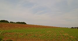
Stone house (Gräfrath)
|
Stone house
City of Solingen
Coordinates: 51 ° 11 ′ 59 ″ N , 7 ° 3 ′ 52 ″ E
|
||
|---|---|---|
| Height : | about 220 m | |
|
Location of stone house in Solingen |
||
|
Approximate location of the desert south of the park cemetery
|
||
Steinenhaus was a residential area in the Gräfrath district of Solingen .
geography
Stone house was located south of today's Gräfrather Parkfriedhof on a hill above the Nümmen court . The farm could be reached via a path from Nümmen Street. The Hofschaft Ehren is a few hundred meters southwest .
Today the desolation of the living space is on the southern extension of the Gräfrath Parkfriedhof.
etymology
The name probably comes from a stone house built there. Up until the 19th century, stone houses were so rare that the entire residential area was sometimes named after them.
history
The Steinenhaus residential area is not yet shown on the map of Erich Philipp Ploennies in 1715 , but it is on the map of the Gräfrather and Burger Grund monasteries from the second half of the 18th century. The topographical survey of the Rhineland from 1824 shows the place as a stone house, the Prussian first survey from 1844 unlabeled. Steinenhaus is recorded north of Ehren on the topographic map of the Düsseldorf administrative district from 1871.
In 1815/16 four people lived in the village. In 1830 Steinenhaus belonged to the mayor's office in Gräfrath , and four people lived in the village at that time. In 1832 Steinenhaus was part of the Gräfrath Honschaft within the Gräfrath mayor's office . The place, which was categorized as a small arable property according to the statistics and topography of the Düsseldorf administrative district , had a residential house and two agricultural buildings at that time. At that time, three residents lived in the village, all of them of Catholic faith. The municipality and estate district statistics of the Rhine Province list the place in 1871 with two houses and ten residents. In the municipality lexicon for the Rhineland province in 1885, three houses with 13 inhabitants are given. In 1895 the place had three houses with 26 inhabitants, in 1905 the place is no longer listed.
At the end of the 19th century, a pit was dug on site.
The estate was presumably abandoned at the turn of the 20th century, as it was no longer listed in the parish dictionary from 1905 and the location was no longer marked on the measuring table pages of the topographic map 1: 25,000 Elberfeld from the 1907 edition. With the town union of Groß-Solingen in 1929, the stone house became a district of Solingen. Today there are open spaces on the site.
swell
- ↑ Lutz Peters: Gräfrath - walks in history. In: Bergischer Geschichtsverein, Solingen e. V. (Ed.), Self-published, Solingen 2012, ISBN 978-3-925626-40-1 , p. 46
- ↑ Plan of the Gräfrather Monastery and Burger Grounds along with an advertisement, such as u. where such are adjacent to the grounds of the parishes of Wald, Sonnborn and Haan. Place Gräfrath and surroundings. Measured by Joh. Wilh. Wülfing, geometra juratus [2. Half of the 18th century]; 180.01.00 RW cards No. 1010; State archive North Rhine-Westphalia Rhineland department
- ^ Topographic map of the Düsseldorf administrative district . Designed and executed according to the cadastral recordings and the same underlying and other trigonometric work by the Royal Government Secretary W. Werner. Edited by the royal government secretary FW Grube. 4th rev. Edition / published by A. Bagel in Wesel, 1859 / Ddf., Dec. 17, 1870. J. Emmerich, Landbaumeister. - Corrected after the ministerial amendments. Ddf. d. Sept. 1, 1871. Bruns.
- ↑ a b Friedrich von Restorff: Topographical-statistical description of the Royal Prussian Rhine Province . Nicolaische Buchhandlung, Berlin / Stettin 1830 ( digitized ).
- ↑ a b Johann Georg von Viebahn : Statistics and topography of the administrative district of Düsseldorf . 1836
- ^ The communities and manor districts of the Rhine Province and their population. Edited and compiled by the Royal Statistical Bureau from the original materials of the general census of December 1, 1871. In: Königliches Statistisches Bureau (Hrsg.): The communities and manor districts of the Prussian state and their population. tape XI , 1874, ZDB -ID 1467523-7 ( digitized ).
- ^ Community encyclopedia for the province of Rhineland. Based on materials from the census of December 1, 1885 and other official sources, edited by the Royal Statistical Bureau. In: Royal Statistical Bureau (Hrsg.): Community encyclopedia for the Kingdom of Prussia. tape XII , 1888, ZDB -ID 1046036-6 ( digitized version ).
- ^ Community encyclopedia for the province of Rhineland. Based on materials from the census of December 1, 1895 and other official sources, edited by the Royal Statistical Bureau. In: Royal Statistical Bureau (Hrsg.): Community encyclopedia for the Kingdom of Prussia. tape XII , 1897, ZDB -ID 1046036-6 .
- ^ Community encyclopedia for the Rhine Province. Based on the materials from the census of December 1, 1905 and other official sources, edited by the Royal Prussian State Statistical Office. In: Königliches Prussisches Statistisches Landesamt (Hrsg.): Community encyclopedia for the Kingdom of Prussia. Booklet XII, 1909, ZDB -ID 1046036-6 .
- ↑ Official city maps of Solingen 1980, 1995

