Grünewald (Solingen)
|
Grünewald
City of Solingen
Coordinates: 51 ° 13 ′ 3 ″ N , 7 ° 4 ′ 37 ″ E
|
||
|---|---|---|
| Height : | about 260 m | |
| Postal code : | 42653 | |
| Area code : | 0212 | |
|
Location of Grünewald in Solingen |
||
|
House Grünewald
|
||
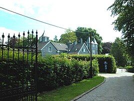
Grünewald is a locality in the mountainous city of Solingen . The place is dominated by the imposing Villa Haus Grünewald .
geography
The location Grünewald is in the extreme north of the Solingen urban area, directly on the city limits of the Gräfrath zu Wuppertal - Vohwinkel district . The building with the Haus Grünewald are two natural listed maple - alleys accessible from the Wuppertal Street to the west and Lützowstraße the east. Immediately to the north-west, already in the Wuppertal city area, is the location of Egidius Klusen , to the north-east is Roßkamp . To the east lie Steinbeck and Schieten , to the south there is a forest area and the housing estate on Abteiweg. To the east lie Kluse , Freudenberg and Piepersberg .
history
In the map series Topographia Ducatus Montani by Erich Philipp Ploennies , Blatt Amt Solingen , from 1715 the place is not recorded. The topographical survey of the Rhineland from 1824 lists the place as Grunewald, the Prussian first survey of 1843 also as Grunewald. The place belonged to the Honschaft Gräfrath within the office of Solingen. In the topographic map of the Düsseldorf administrative district from 1871, the court is listed as Grünewald .
After the establishment of the Mairien and later mayor's offices at the beginning of the 19th century, Grünewald was part of the Gräfrath mayor's office . The Grünewald House, which dominates the town today, was built between 1817 and 1824. In 1815/16 there were seven residents, and in 1830 seven people lived in the village, which was categorized as a farm and a good . In 1832 Grünewald was still part of the Gräfrath Honschaft within the Gräfrath mayor. The place, which was categorized as arable property in 1836 according to the statistics and topography of the Düsseldorf administrative district , had a house and an agricultural building. At that time, six people lived in the village, all of them of Catholic faith.
At the end of 1837, Louis de Leuw bought the Grünewald house (Gräfrath No. 161) including fields and woods from Peter Adolf Kaiser on behalf of his father, the ophthalmologist Dr. Friedrich-Hermann de Leuw, and devoted himself to agriculture for the next two years. Constantin de Leuw, the fourth son, lived there at least from 1847 to 1849, with two servants, a maid, twelve cows, three cattle, two horses and two pigs, but moved back to the town center after his marriage in 1850. From 1862 to around 1868 at the latest, the first son, Friedrich-August , moved in there, whose four children were born on Gut Grünewald, as it was then called.
The municipality and estate district statistics of the Rhine Province list the place in 1871 with one house and eleven inhabitants. In the municipality lexicon for the Rhineland province in 1885, five houses with 29 inhabitants are given. In 1895 the district had four houses with 29 inhabitants, in 1905 six houses and 34 inhabitants are given.
With the city association of Groß-Solingen in 1929, Grünewald became a district of Solingen.
swell
- ^ Topographic map of the Düsseldorf administrative district . Designed and executed according to the cadastral recordings and the same underlying and other trigonometric work by the Royal Government Secretary W. Werner. Edited by the royal government secretary FW Grube. 4th rev. Edition / published by A. Bagel in Wesel, 1859 / Ddf., Dec. 17, 1870. J. Emmerich, Landbaumeister. - Corrected after the ministerial amendments. Ddf. d. Sept. 1, 1871. Bruns.
- ↑ Johann Georg von Viebahn : Statistics and Topography of the Administrative District of Düsseldorf , 1836
- ↑ Friedrich von Restorff : Topographical-statistical description of the Royal Prussian Rhine Province , Nicolai, Berlin and Stettin 1830
- ↑ Friedrich von Restorff : Topographical-statistical description of the Royal Prussian Rhine Province , Nicolai, Berlin and Stettin 1830
- ↑ a b Johann Georg von Viebahn : Statistics and Topography of the Administrative District of Düsseldorf , 1836
- ^ Municipal administration Gräfrath: Grundsteuererkataster Gräfrath 1839. In: www.familysearch.de. Retrieved December 23, 2018 .
- ^ De Leuw, Ludovicus: De macroglossa seu linguae prolapsu. P. 48: "agriculturae operam navarem". In: Dissertation Friedrich Wilhelm University of Berlin. June 28, 1845, Retrieved December 23, 2018 (Latin).
- ^ Municipal administration Gräfrath: Citizens' roles: censuses. In: Files G389 / G390. 1847, accessed December 23, 2018 .
- ^ City administration Gräfrath: Birth certificate Adeline Maria Elisabeth de Leuw . Ed .: City Archives. Solingen June 20, 1862.
- ↑ Royal Statistical Bureau Prussia (ed.): The communities and manor districts of the Prussian state and their population . The Rhine Province, No. XI . Berlin 1874.
- ↑ Königliches Statistisches Bureau (Prussia) (Ed.): Community encyclopedia for the Rhineland Province, based on the materials of the census of December 1, 1885 and other official sources, (Community encyclopedia for the Kingdom of Prussia, Volume XII), Berlin 1888.
- ↑ Königliches Statistisches Bureau (Prussia) (Ed.): Community encyclopedia for the Rhineland Province, based on the materials of the census of December 1, 1895 and other official sources, (Community encyclopedia for the Kingdom of Prussia, Volume XII), Berlin 1897.
- ↑ Königliches Statistisches Bureau (Prussia) (Ed.): Community encyclopedia for the Rhineland Province, based on the materials of the census of December 1, 1905 and other official sources, (Community encyclopedia for the Kingdom of Prussia, Volume XII), Berlin 1909.

