
Taalsee
| Taalsee | ||
|---|---|---|

|
||
| Satellite photo of the Taalsee with the volcanic island in its center | ||
| Geographical location | Batangas Province , Luzon , Philippines | |
| Drain | Pansipit River → Sibuyan Lake | |
| Islands | Volcano Island | |
| Data | ||
| Coordinates | 13 ° 59 ′ N , 121 ° 1 ′ E | |
|
||
| surface | 234.2 km² | |
| length | 25 km | |
| scope | 115 km | |
| Maximum depth | 172 m | |
|
particularities |
Caldera , Taal Volcano National Park |
|

The Taalsee or Lake Taal is a freshwater lake on the Philippine island of Luzon . The lake is located within a caldera that was formed by a powerful volcanic eruption about 500,000 to 100,000 years ago.
Lake Taal was previously known as Lake Bombon and is the third largest lake in the island state, after Laguna de Bay and Lake Lanao on Mindanao . The active Taal Volcano , which is responsible for the lake's sulfur content, is located on an island in the center of the water called Volcano Island . The island is also called Pulo or islet by the locals . In the middle of this island is a crater lake, which is the world's largest lake on an island in a lake on an island - and it itself contains a very small island: Vulcan Point . In 1996 the Taalsee was declared a Taal Volcano National Park.
geography

The lake is located in the center of Batangas Province, about 60 km from the capital Manila . It has a maximum length of 25 km and a width of 18 km. With a depth of up to 172 m, it is considered the deepest lake in the country. Its area is 234.2 km² and its coastline takes up a total of 115 km.
On its coast, clockwise, lie the towns of Talisay in the north, Tanauan City in the northeast, Balete , Mataas na Kahoy and Lipa City in the east, Cuenca , Alitagtag , Santa Teresita and San Nicolas in the south, Agoncillo in the west, and Laurel in the northwest.
Its outflow is the Pansipit River, which emerges at the south-western corner of the lake and flows about 10 km to Balayan Bay. In the northwest, a ridge rises as part of the enlarged crater rim up to 640 m above sea level, on which the largest city in the catchment area, Tagaytay City , is located. In the south and east, on the other hand, the surroundings are usually much more sloping.
The area is still volcanically active. On the volcanic island in the middle of the lake there is another crater lake with a water surface of 30 hectares , which was created by an eruption in 1911. A newer crater is located 2 km from the crater lake and was formed in an eruption in 1967. There are two islands in the lake. In addition to the already mentioned striking Volcano Island, with a land area of 45 km², the Taalsee includes the island of Laurel Island with an area of almost one square kilometer.
history
The Taalsee was originally a wide arm of the Balayan Bay . A series of powerful eruptions in the 16th century created a land bridge that separated the lake from the sea. Today only the Pansipit River represents a connection between the lake and the sea. Over the centuries, rainfall has diluted the formerly salty water and turned it into fresh water.
Due to numerous subsequent eruptions, many settlements near the volcano were burned down, so that today only three villages are located directly on the coast of the lake. In contrast, many of the buildings and ramparts that were formerly on the lake are now below the waterline of the Taalsee.
ecology
Fish fauna

Since the lake was previously connected to the sea, it is still home to many types of salt water that have adapted to the desalination of the lake water. There are two endemic fish species in the lake, Sardinella tawilis, a freshwater sardine , and Barbodes hemictenus , a barb. In the lake there is the species of jackfish, Caranx ignobilis , which is adapted to fresh water . This fish is also found in the Pansipit River and is called Maliputo in the local language . The most important fish is a type of herring Harengula tawilis , which is the most important source of life in fishing. The fish fauna also includes important migratory fish , such as mullets (Mugilidae), which move up the Pansipit River together with the mackerel at a young age, spend their lives in the lake until sexual maturity and then return to the sea. These fish ultimately form the basis of the local fishing industry at Taalsee. However, due to overfishing , the number of fish in the river is steadily decreasing.
The bull shark ( Carcharhinus leucas ) was also once part of the lake's diverse ecosystem before being wiped out by local residents in the 1930s. The Taalsee is still home to the rare sea snake Hydrophis semperi , one of only two known sea snake species that live entirely in fresh water.
Most of the catchment area has been deforested and has been prepared for agriculture. The coconut cultivation plays an important role. It is associated with other useful plants such as coffee , cocoa and cassava , which are planted between the trunks of the coconut palms. Other areas are dominated by grasslands ( Imperata cylindrica ) and are used as pastures for cattle breeding.
Fish death
On January 5, 2008, the Bureau of Fisheries and Aquatic Resources (BFAR) reported a fish mortality that occurred in Taal Lake between January 2 and 4 and the loss of 50 cubic meters of farmed tilapia in the Value of about 3.25 million PHP (about 56,000 €) in the villages of Leviste and Balakilong of Laurel parish and in Barangay Aya and Barangay Quiling in Talisay . In addition, another 6,000 maliputo fish died in Quiling. The local catastrophe was due to the occurrence of toxic sulfur together with high levels of hydrogen sulfide and, at the same time, low levels of dissolved oxygen that had developed in the lake near Ambulong.
tourism

Tours to the lake are regularly offered to tourists. After crossing the lake, visitors can climb to the top of the volcano on horseback and get an impressive overview of the lake and the surrounding landscape.
Around the middle of 2007, the South Korean company Jung Ang Interventure planned to build a spa on the volcanic island. However, after controversial discussions among various members of the government and due to public criticism, the plans were postponed until further notice.
gallery
Taal volcano

Taal volcanic crater lake in 2005

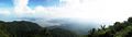
Taalkrater panorama in October 2007

Individual evidence
- ↑ a b c d e ilec.or.jp ( Memento of the original from March 6, 2012 in the Internet Archive ) Info: The archive link was inserted automatically and has not yet been checked. Please check the original and archive link according to the instructions and then remove this notice. Data on the Taalsee
- ↑ Fishbase : Species in Taal Lake
- ↑ Article on Inquirer.net, Taal Lake fishkill causes P3-M losses ( Memento of the original from January 17, 2008 in the Internet Archive ) Info: The archive link was automatically inserted and not yet checked. Please check the original and archive link according to the instructions and then remove this notice.
Web links
- Global Nature Fund: Taalsee .
- Philippine Journeys: Trek to Taal Volcano .