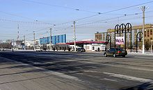
Temirtau
|
||
| Basic data | ||
|---|---|---|
| State : |
|
|
| Territory : | Karagandy | |
| Founded : | 1909 | |
| Coordinates : | 50 ° 4 ′ N , 72 ° 58 ′ E | |
| Height : | 513 m | |
| Area : | 296.1 km² | |
| Residents : | 179,216 (Jan 1, 2020) | |
| Population density : | 605 inhabitants per km² | |
| Time zone : | EKST ( UTC + 6 ) | |
| Telephone code : | (+7) 7213 | |
| Postal code : | 101400 | |
| License plate : | 09 (old: M, K) | |
| Äkim ( Mayor ) : | Ghalym Aschimov | |
| Website : | ||
| Location in Kazakhstan | ||
|
|
||
Temirtau ( Kazakh Теміртау "iron mountain", Russian Темиртау ) is an industrial city in Kazakhstan with 179,216 inhabitants (as of January 1, 2020). It is a satellite city of Karagandy and is located about 180 km southeast of the capital Nur-Sultan on the Nura River . The settlement of Aqtau is subordinate to the administration of the city of Temirtau .
history
The city was founded on October 1, 1945 on the basis of the former Samarkandskij settlement . In August 1959, violent riots in the city killed 16 people.
Sports
The city is home to the football club FK Schachtjor-Bolat Temirtau . The city is also represented by the HK Arystan Temirtau ice hockey club .
Economy and Infrastructure
The history of the city is closely linked to the Kazakh Metallurgy Combine (Karmet), which was built on December 31, 1944 during the German occupation of the western part of the USSR in World War II and is now part of ArcelorMittal . There is also an electrometallurgical combine in the city today . In addition, 1,061 industrial companies are located in the city, which in 2007 produced 23 percent of the industrial production of the entire area.
traffic
Since September 5, 1959, the place has had a tram with a track width of 1524 mm and a total length of 48.8 km.
Local transport is provided by five transport companies over a total length of drivable roads of 259 km.
The 921 km long A20 highway begins north of the city .
media
Six local newspapers appear in the city ( Temirtau , Serkalo , Kazakhstan Magnitka , Metallurg , Temirtauskij kaleidoskop and Wetschernjaja Gazeta ). There are also four local telecommunications channels ( Sfera , 29 channels , 43 channels and TKT ) and a radio station ( Radio-102 ).
education
Temirtau has 30 general education schools with a capacity of more than 19,000 students and two universities.
SOS Children's Village Temirtau
The unemployment rate in the region around Temirtau is high and the number of orphans and abandoned children is high.
The local authorities provided around seven hectares of land free of charge for the construction of the SOS Children's Village Temirtau. The official opening took place on July 5, 2005 in the presence of representatives from SOS Children's Villages International and numerous guests of honor.
The SOS Children's Village Temirtau comprises twelve family houses, houses for the SOS aunts (support the SOS Children's Village mothers and represent them in the event of their absence) and the village director, a multi-purpose building and an administration and service area. Up to 108 children can find a new home in the family houses of the SOS Children's Village Temirtau. Since the need for family-like long-term accommodation for children is still high, the construction of two additional family houses is planned for the coming years.
Town twinning
-
 Zenica ( Bosnia and Herzegovina )
 -
 Kamjanske (formerly Dniprodzerzhynsk, Ukraine )
sons and daughters of the town
- Serik Akhmetov (* 1958), Kazakh politician
- Vladimir Antipin (* 1970), Kazakh ice hockey player
- Willi Evseev (* 1992), German soccer player
- Dmitri Frolov (* 1966), Russian ice hockey player
- Wadim Glowazki (1970-2015), Kazakh ice hockey player
- Valery Yablotschkin (* 1973), Kazakh football player
- Sergei Jakowlew (* 1976), Kazakh racing cyclist
- Vitali Janke (* 1976), German ice hockey player
- Eugen Kamenew (* 1982), German-Russian photographer
- Nikita Miller (* 1987), German-Russian comedian, author and cartoonist
- Dariga Nazarbayeva (* 1963), Kazakh entrepreneur
- Marija Ovtschinnikowa (* 1998), long and triple jumper
- Andrei Potaitschuk (* 1970), Russian ice hockey player
- Valentina Rekowski (* 1984), German film and theater actress and voice actress
- Anton Sagadejew (* 1993), Kazakh ice hockey player
- Wladimir Wochmjanin (* 1962), Kazakh sports shooter
See also
Web links
Individual evidence
- ↑ Численность населения Республики Казахстан по полу в разрезе областей и столицы, столицы, столицы, анколицы, столицы, городоав, областей и столицы, анкония, горойцы, коники, городоав,. ( Excel ; 96 KB) stat.gov.kz, accessed on July 19, 2020 (Russian).
- ^ SOS Children's Village Temirtau


