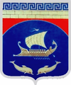
Tschornomorske
| Tschornomorske | ||
| Чорноморське | ||

|
|
|
| Basic data | ||
|---|---|---|
| Oblast : | Autonomous Republic of Crimea | |
| Rajon : | Chornomorske district | |
| Height : | 7 m | |
| Area : | 119 km² | |
| Residents : | 11,643 (2004) | |
| Population density : | 98 inhabitants per km² | |
| Postcodes : | 96400 | |
| Area code : | +380 6558 | |
| Geographic location : | 45 ° 31 ' N , 32 ° 42' E | |
| KOATUU : | 125655100 | |
| Administrative structure : | 1 urban-type settlement | |
| Mayor : | Serhiy Kryvobokov | |
| Address: | вул. Кірова 19 96400 смт. Чорноморське |
|
| Statistical information | ||
|
|
||
Tschornomorske ( Ukrainian Чорноморське - until 1944 Акмечит / Akmetschyt ; Russian Черноморское / Tschernomorskoje , Crimean Tatar Aqmeçit ) is an urban-type settlement in the Autonomous Republic of Crimea . It is located in the west of the Crimean peninsula in Ukraine , 140 kilometers northeast of Simferopol in a bay on the Black Sea and is the administrative center of the Chornomorske district .
The settlement Kalos-Limen, built by the Greeks, was built in the area of the present-day town as early as the 4th century BC . Over time, the Greek name became Akmesdschit Liman , from which the Crimean Tatar name Aqmeçit was derived. In the 20th century the place became a center of agriculture, in 1944 it was renamed Tschornomorske / Tschernomorskoje (after the Russian name for "Black Sea"), since 1957 it has been an urban-type settlement .


