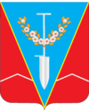
Nyschnjohirskyj
| Nyschnjohirskyj | ||
| Нижньогірський | ||

|
|
|
| Basic data | ||
|---|---|---|
| Oblast : | Autonomous Republic of Crimea | |
| Rajon : | Nyschnjohirskyj district | |
| Height : | 22 m | |
| Area : | 2.0164 km² | |
| Residents : | 9,436 (2016) | |
| Population density : | 4,680 inhabitants per km² | |
| Postcodes : | 97100 | |
| Area code : | +380 6550 | |
| Geographic location : | 45 ° 27 ' N , 34 ° 44' E | |
| KOATUU : | 123155100 | |
| Administrative structure : | 1 urban-type settlement , 2 villages | |
| Mayor : | Olexander Oleksijowytsch Konokhov | |
| Address: | вул. Шкільна 8а 97100 смт. Нижньогірський |
|
| Website : | http://nijno.rk.gov.ru | |
| Statistical information | ||
|
|
||
Nyschnjohirskyj (Ukrainian Нижньогірський ; Russian Нижнегорский / Nizhnegorski , Crimean Tatar Seyitler ) is an urban-type settlement and the administrative center of the raion of the same name in the east of the Autonomous Republic of Crimea , Ukraine with 9400 inhabitants (2016). The village is a traffic junction for rail and road traffic.
geography
Nyschnjohirskyj is located on the highway M 17 as well as on the railway line of Dzhankoi according Kertsch . The distance to the southwestern capital of Crimea, Simferopol , is 91 km and that to the northwestern Armyansk is 128 km. In addition to Nyschnjohirskyj, the settlement council also includes the villages Selene ( Зелене ) with about 1100 inhabitants and Linijne ( Лінійне ) with about 500 inhabitants.
history
The exact date of the establishment of Sejitler (Ukrainian Сеїтле́р ), the original name of the village, is not known. It is probably in the 17th century. Since 1938 the village has had the status of an urban-type settlement. On October 30, 1941, the village was occupied by Wehrmacht troops. The settlement was liberated by the Red Army on April 12, 1944 and in the same year the village was renamed Nyschnjohirskyj in connection with the deportation of the Crimean Tatar population.
Population development
| 1805 | 1896 | 1926 | 1959 | 1970 | 1979 | 1989 | 2001 | 2016 |
|---|---|---|---|---|---|---|---|---|
| 62 | 475 | 996 | 4,208 | 7,570 | 9,344 | 10,453 | 10,466 | 9,436 |
Source: 1805-1926; from 1959
Personalities
- Serhiy Dsindsiruk (* 1976) Ukrainian boxer
Rajon
Nyschnjohirskyj is the administrative seat of the raion of the same name. Nyschnjohirskyj Raion is located in the east of the Crimean peninsula. It borders in the north on the coast of the Sywasch , a bay system in front of the Sea of Azov , and in the south on the foothills of the Crimean Mountains . It has 50,600 inhabitants and an area of 1212 km². The population density is 42 inhabitants per km².
Web links
- History of Towns and Villages / Nyschnjohirskyj (Russian)
- Rajons website (Russian)
Individual evidence
- ↑ a b Demography of Ukrainian cities on pop-stat.mashke.org
- ↑ a b History of Towns and Villages / Nyschnjohirskyj (Russian)


