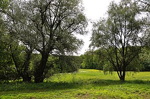
Lower Körschtal
|
Landscape protection area "Unteres Körschtal"
|
||
| location | Deizisau , Denkendorf , Esslingen am Neckar and Koengen in the Esslingen district in Baden-Württemberg , Germany | |
| surface | 4.74 km² | |
| Identifier | 1.16.014 | |
| WDPA ID | 325343 | |
| Geographical location | 48 ° 42 ' N , 9 ° 21' E | |
|
|
||
| Setup date | October 19, 1978 | |
| administration | Esslingen district | |
Lower Körschtal is a protected landscape area (protected area number 1.16.014) in the Esslingen district .
Location and description
The protected area is located in the Körschtal and Neckar valleys between the communities of Denkendorf in the southwest and Deizisau in the northeast. It belongs to the natural area 106- Filder within the natural spatial main unit 10- Swabian Keuper-Lias-Land .
Protection purpose
According to the Protected Area Ordinance, an essential protection purpose is the preservation of the lower Körschtal in its natural structure and diversity, including slopes and surroundings as an ecological compensation area and recreational area in the southeast of the Stuttgart metropolitan area.
See also
- List of landscape protection areas in the Esslingen district
- List of landscape protection areas in Baden-Württemberg
literature
- Landscape protection areas in the Esslingen district, published by the State Institute for Environmental Protection Baden-Württemberg 1985, ISBN 3-88251-102-8 , p. 67
Web links
- Profile of the landscape protection area in the protected area directory of the LUBW


