
Waterloo Square
The Waterlooplatz in Hanover is about four hectares of lawn in the Calenberger Neustadt district . The Waterloo Column stands in the square . The square and column were built in the 19th century to commemorate the Battle of Waterloo . While the square originally surrounded a barracks area when it was built in the first half of the 19th century, today it is located in the middle of the government and administrative district of the Lower Saxony state capital.

Location and description


The approximately 400 × 100 meter rectangular Waterlooplatz is located southwest of the old town within sight of the Lower Saxony state parliament . The area is open to the public and is occasionally used for hot air balloon launches and events such as circus performances and shows. In 2006, an arena was set up on the square, in which public viewing of the 2006 World Cup took place on a big screen. This was repeated in 2012 for the 2012 European Football Championship .
In the southern area of the square is the 46 m high Waterloo Column designed to form the Victory Column . The square is designed as a lawn and has rows of trees on the edges. The four surrounding streets represent a demarcation. Only the traffic routes on the long sides are worth mentioning. These are the four-lane Lavesallee arterial road in the northwest and the quiet street "Am Waterlooplatz" in the southeast. The underground tram stop “Waterloo” is located under Waterlooplatz.
history
The Waterlooplatz was built at the beginning of the 19th century together with the Waterloo Column. Both served as a reminder of the victory in the Battle of Waterloo , which troops of the Kingdom of Hanover also won against Napoléon in 1815 .
It was the first large parade ground and military parade ground in Hanover that the soldiers stationed here used. The barracks around the square were still outside the gates of the city of Hanover. The bastion-like city fortifications were loosened from 1763. Ramparts and walls were razed in order to be able to expand the buildings and the road network.
The square was designed on the drawing board of the court architect Georg Ludwig Laves , the leading architect of the Kingdom of Hanover. The square extended the line of sight of the former Leineschloss (today Lower Saxony State Parliament) to the southwest. The work on the construction of the square and column lasted from about 1826 to 1832.
Originally, Waterlooplatz was a rectangular area with semicircular ends. To the south of the square, a ditch led past the Leine, which dumped sewage from the barracks on Waterlooplatz. With the introduction of a sewer system around 1900 it was filled in.
Military buildings
When the Waterlooplatz was laid out at the beginning of the 19th century, a number of military buildings were built on its sides. A similarly military-related method of origin is the case in Hanover at Welfenplatz and Königsworther Platz .
Immediately on Waterlooplatz, on the north-west side, were the infantry barracks 2 and 3, initially referred to as guard hunter and guard grenadier barracks. Opposite on the south-east side were the infantry barracks 1, the later Hindenburg barracks and the main armory, the later artillery depot . Around 1,100 infantrymen were stationed directly at the site from the time it was built up until the 20th century. In the wider area around the square there were around 25 military facilities, such as a hospital, detention center, clothing store and representative service apartments for officers and commanders.
Royal Main Armory


The main royal armory was the successor to the armory on the Hohen Ufer (now part of the Historisches Museum am Hohen Ufer ) , which was planned as early as 1833 but was not built until 1849 as a result of the revolution of 1848 . It was the largest building complex on Waterlooplatz, and later also an artillery depot . Karl Friedrich Schinkel prepared an expert opinion beforehand, Rudolf Wiegmann a draft. After a competition announcement by the War Ministry, Konrad Stremme won (2nd place: Ludwig Hellner ). The construction was carried out in the Florentine Renaissance with protruding corner buildings.
Military equipment such as artillery , vehicles, gunpowder , dishes and weapons of all kinds was stored in the building. The armory complex was built in 1845–49 on the southeast side of the square. This included the main armory, an 85 m long and 18 m wide three-storey building with twelve entrances. The building had two 40 m long wings. Gun barrels and vehicles were stored on the ground floor . Rifles and sabers were kept on the first and second floors .
Two additional armory were built on the east side of the property on today's Waterloostrasse opposite the war school and the police headquarters, which was completed in 1903. The two three-storey armories were 81 m long and about 13 m wide. They housed vehicles on the ground floor and first floor, and crockery on the top floor.
The air raids on Hanover in World War II left a well-preserved ruin, which was torn down in 1955 in order to build a new building for the regional finance office.
Infantry barracks 1

The main building of Infantry Barracks 1 and later Hindenburg Barracks was erected in 1833 as a 52 m long brick building on the south-east side of the square. The barracks stood on a 110 × 41 m site. The barracks building had three floors and a basement. It was built the length of the street front and had two wings, each 20 m long, in the depth of the property. The basement had 27 rooms and was intended for the kitchen, laundry room, coal cellar and storage rooms. The crew rooms were occupied by an average of 10-15 soldiers . Each housed soldier had around 17 m³ of space available, twice to four times as much for the officers. The barracks had a capacity for 560 soldiers, but around 1900 it was only occupied by 450 soldiers. Of these, 420 soldiers had ranks and 30 were officers .
In addition, there were a number of outbuildings, such as a 50 m long building with a kitchen, dining room, infirmary, bathroom and workshops, such as that of the gunsmith . Other buildings were a 38 m long parade house and a latrine . Since the barracks were in the Leinen lowland , water often entered the cellars in the early years when the river flooded. By 1900 the area was drained and regulated to such an extent that this no longer occurred.
Today the well-preserved building houses a location for the General Directorate for Waterways and Shipping .
Barracks 2
Infantry barracks 2 on the north-west side of the square was built in 1831 and was intended as a commandant's office. In 1839 the 40 m long building was extended by adding a wing and used as a barracks. The main building had three floors and a basement. The occupancy conditions were similar to infantry barracks 1. There were also similar outbuildings.
The barracks was designed for 415 men, but was only occupied by about 320 soldiers around 1900. Today the buildings of the barracks no longer exist. They were roughly at the same level as today's Hanover Central Tax Office and the Lower Saxony Ministry of the Interior .
Barracks 3
Infantry barracks 3 on the north-west side of the square was built in 1831 right next to barracks 2. The 52 m long main building made of bricks was built on three floors with a cellar. It had two wings. Around 1900 the barracks were occupied by around 400 soldiers. The occupancy conditions were similar to infantry barracks 1. There were also similar outbuildings.
The barracks no longer exist today; it was roughly at the level of today's Hannover-Mitte tax office.
War school


Another military facility near Waterlooplatz was the war school . The building complex was built on today's Waterloostrasse in the years 1842–43 as the Royal Cadet Institute . The main building on the street front was 60 m long and had two 20 m long side wings in the depth of the property. An intermediate building and an approximately 25-long teaching building were added to this in 1894. The buildings had a basement and had three floors. Architecturally, the facades were held in the arched style. Outbuildings were a covered riding arena, a fencing and gymnastics shed, latrine, gun shed, bowling alley and horse stables.
120 war students were housed in the war school. They had a room volume of 52 m³ per person at their disposal, which was more than double the space for soldiers in other barracks. The large room volume was achieved by the extraordinary floor height of 5 m, which severely impaired the heating capacity of the rooms.
After the annexation of the Kingdom of Hanover, the institution was renamed the Prussian War School in 1867 . Since 1919 the buildings have belonged to the then police headquarters and the Hanover Police Department , which had built a new building on the neighboring property in 1903. The main building of the former war school was badly damaged by bombing during World War II. The ground floor, which still has the original entrance door to the street front, has been preserved. The teaching building of the war school was completely preserved.
After the Second World War


During the bombing raids on Hanover during the Second World War, the military installations around Waterlooplatz were badly affected. Many of the buildings damaged or destroyed in this way were demolished after the war, such as the main armory in 1955. Today only a few remains bear witness to the military past of the square. Infantry Barracks 1 with a location for the General Directorate for Waterways and Shipping has been completely preserved . Several parts of the war school on Waterloostraße on what is now the site of the police headquarters have been preserved.
After the war, administrative and government buildings were built on the vacated areas of the destroyed barracks on Waterlooplatz, for which there was enough space. City planning officer Rudolf Hillebrecht developed the plan in 1948 to set up the state government's government district around Waterlooplatz. It was therefore close to the Lower Saxony state parliament , which was set up in the rebuilt Leineschloss . Other urban areas planned after 1945, such as Hohenzollernstrasse on the Eilenriede and Warmbüchenkamp as well as the Schiffgraben , were insufficient in terms of area and urban planning for ministries, the state parliament and the state chancellery.
In 2016, a container village for 120 refugees was built on the lawn of Waterlooplatz on around 4000 m², as well as a day-care center. As part of the Hannover City 2020 + project , the hippodrome shape of the square, which goes back to builder Laves , is to be restored.
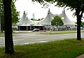
Cats -Theatre Tent on Waterlooplatz, 2011

Public viewing on the pitch for the 2012 European Football Championship


Metro station

On November 16, 1965, construction of the Hanover light rail began at Waterlooplatz . Almost three years later, on August 31 and September 1, 1968 , at the instigation of the city administration , the first partially completed construction site, which was still open at the top, was able to attend the “Open Day Door ”. This is where the four-track subway station Waterloo on light rail line A was built . According to the original subway plans, the A-South and A-West routes were to be continued from this station. In addition, an underground sweeping system was to be built. In view of these plans, some preliminary construction work was carried out during the construction of the station , which can be seen in the southern part of the station.
On September 28, 1975 the first light rail line was opened from the main train station via Waterloo to Oberricklingen . Initially, only the two inner tracks of the station were used, which led to the ramp in Gustav-Bratke-Allee. In 1979, the A-West route towards Empelde was also connected to the tunnel via the ramp.
In 1999 the two outer tracks were put into operation with the construction of the Legion Bridge . Lines 3 and 7 no longer drove via Schwarzer Bär , but directly to the Siloah hospital stop (now Allerweg ). The original plan to continue the route underground was abandoned and instead crossed the Ihme with a bridge. During the construction of the extension, an advance construction work was again created in the form of a short tunnel section. This makes it possible one day to relocate the A-West route into a tunnel through Linden-Mitte .
The previously largely unadorned concrete walls of the subway station, which was completed under great time pressure, were completely renovated in 2013/14 and provided with images and panels on the city's history.
literature
- Description of the Hanover garrison from the point of view of the health system . Edited by the Medical Authority of the Royal Prussian War Ministry, Berlin 1896.
Web links
- 360 degree panorama of the square
- Brief description at hannover.de
Individual evidence
- ↑ Klaus Mlynek, Waldemar R. Röhrbein (eds.) And a .: City Lexicon Hanover . From the beginning to the present. Schlütersche, Hannover 2009, ISBN 978-3-89993-662-9 , p. 689.
- ^ Photo of the demolition of the armory on Waterlooplatz in 1955
- ↑ Start of construction for container village in the middle of the city | Here they tear open Waterloo Square , bild.de, February 5, 2016
- ↑ 30 new places for quarters: Refugees should go to Waterlooplatz , Hannoversche Allgemeine Zeitung, July 14, 2015
- ↑ Hannover City 2020+
- ^ Annotated image comparison of two almost identical photographer locations from 1965 and around 2013 in Michael Narten: Zeitreise durch Hannover. Cityscapes then and now , Hannover: Leuenhagen & Paris, 2013, ISBN 978-3-923976-93-5 , pp. 70f.
- ↑ Underground stations. ( Memento from June 29, 2013 in the Internet Archive ) In: Uestra.de .
- ↑ Bernd Haase: Oldest tunnel station. History lesson under Waterlooplatz. In: Hannoversche Allgemeine Zeitung , August 16, 2013.
- ↑ Waterloo redesigned: history in the light rail station . ( Memento from May 3, 2014 in the Internet Archive ) on Hannover.de, April 30, 2014
Coordinates: 52 ° 22 '2 " N , 9 ° 43' 43" E