Yelisovo
| city
Yelizovo
Елизово
|
||||||||||||||||||||||||||||||||||||||||||
|
||||||||||||||||||||||||||||||||||||||||||
|
||||||||||||||||||||||||||||||||||||||||||
| List of cities in Russia | ||||||||||||||||||||||||||||||||||||||||||
Jelisowo ( Russian Елизово ) is a city in the Kamchatka Region ( Russia ) with 39,569 inhabitants (as of October 14, 2010).
geography
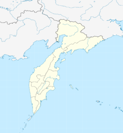
The city is located on the east side of the Kamchatka Peninsula , about 30 km northwest of the regional capital Petropavlovsk-Kamchatsky , on the Avacha River about 20 km above its mouth in the Avacha Bay of the Pacific .
The city of Jelisowo is the administrative center of the Rajon of the same name .
history
A Russian village was built in 1848 instead of an old Itelmen settlement; later an ostrog was built and the place called Stary Ostrog (Old Ostrog). From 1897 the village was called Sawoiko , after the former military governor of the Oblast Admiral Wassili Sawoiko (1809–1898). In 1924 it got its current name after the red partisan commander Georgi Matwejewitsch Jelisow, who died in 1922 in Kamchatka . In 1964, Jelisowo received urban-type settlement status and in 1975 city rights.
Population development
| year | Residents |
|---|---|
| 1959 | 4,532 |
| 1970 | 14,485 |
| 1979 | 36.210 |
| 1989 | 46,929 |
| 2002 | 41,533 |
| 2010 | 39,569 |
Note: census data
Culture and sights
Jelisowo is a regional tourist center.
The city has a local history museum and the Kronotsky Biosphere Reserve Museum .
Economy and Infrastructure
Jelisowo is the center of an agricultural area of local importance (meat and dairy farming, vegetable growing). In addition to companies in the food industry, there are wood and construction industries.
Petropavlovsk-Kamchatsky Airport is located southeast of the city . The place is also on the island's most important trunk road (R474) from Petropavlovsk-Kamchatsky to Ust-Kamchatsk in the north of the peninsula, from which a road to Vilyuchinsk branches off here.
In Jelisowo there is also a long-wave radio transmitter with a transmission power of 150 kW, which uses a 255 meter high transmission mast with an ARRT antenna as a transmitting antenna.
Personalities
- Alexei Boltenko (* 1979 in Jelisowo), biathlete
- Alexander Choroschilow (* 1984 in Jelisowo), ski racer
- Dmitri Yaroshenko (* 1976), biathlete , grew up in Jelisowo
- Yuri Kudrjaschow (* 1946), biathlete
Web links
- City administration website (Russian)
Individual evidence
- ↑ a b Itogi VPN-2010. Administrativno-territorialʹnoe delenie kraja. (Results of the 2010 census. Administrative-territorial division of the region.) Table 2 (Download from the website of the Territorial Organ of the Kamchatka Region of the Federal Service of State Statistics of the Russian Federation)


