Zemendorf-Stöttera
|
Zemendorf-Stöttera
|
||
|---|---|---|
| coat of arms | Austria map | |
|
|
||
| Basic data | ||
| Country: | Austria | |
| State : | Burgenland | |
| Political District : | Mattersburg | |
| License plate : | MA | |
| Main town : | Zemendorf | |
| Surface: | 12.82 km² | |
| Coordinates : | 47 ° 46 ' N , 16 ° 27' E | |
| Height : | 198 m above sea level A. | |
| Residents : | 1,286 (January 1, 2020) | |
| Postal code : | 7023 | |
| Community code : | 1 06 18 | |
| NUTS region | AT112 | |
| UN / LOCODE | AT ZMD | |
| Address of the municipal administration: |
Zemendorf-Stöttera community 7023 Zemendorf-Stöttera |
|
| Website: | ||
| politics | ||
| Mayor : | Josef Haider ( ÖVP ) | |
|
Municipal Council : ( 2017 ) (19 members) |
||
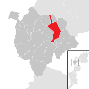
| Location of Zemendorf-Stöttera in the Mattersburg district | ||
| Source: Municipal data from Statistics Austria | ||
Zemendorf-Stöttera is a municipality with 1286 inhabitants (as of January 1, 2020) in Burgenland in the Mattersburg district in Austria .
The Hungarian place name of the municipality is Zemenye-Selegd .
geography
Geographical location
The municipality of Zemendorf-Stöttera is located in the Wulka plain . The settlement areas of the municipality are divided into the merged villages of Stöttera and Zemendorf, these are located on the Wulka a few kilometers northeast of Mattersburg , as well as the Kirchweiler Kleinfrauenhaid .
Community structure
The municipality includes the following two localities and cadastral communities of the same name (residents as of January 1, 2020):
- Stöttera (545)
- Zemendorf (741)
history

Before the birth of Christ, the area was part of the Celtic Kingdom of Noricum and belonged to the surroundings of the Celtic hill settlement Burg on the Schwarzenbacher Burgberg .
Later, under the Romans, today's places Stöttera and Zemendorf were then in the province of Pannonia .
Like all of Burgenland, the place belonged to Hungary (German-West Hungary) until 1920/21 . Since 1898 had due to the Magyarization of the government in Budapest of Hungarian name Zemenye-Selegd be used.
After the end of the First World War , after tough negotiations, German-West Hungary was awarded to Austria in the Treaties of St. Germain and Trianon in 1919. The place has belonged to the newly founded federal state of Burgenland since 1921 (see also the history of Burgenland ).
The district of Stöttera was called Stöttern until 1926.
The previously independent municipalities of Zemendorf and Stöttera decided in 1938 to build a joint elementary school. In 1939 it was merged to form the municipality of Zemendorf-Stöttera. The parish hall of Stöttera was sold for the construction of the elementary school. The repair of the bridges and the renovation of the church were among the first reconstruction measures after the Second World War . In the years that followed, freight routes were expanded.
In 1971 the municipality of Zemendorf-Stöttera was merged with the municipality of Pöttelsdorf to form the new municipality of Pöttelsdorf. In 1991 the large community was dissolved again. The community of Zemendorf-Stöttera remained independent, with the administrative seat in Zemendorf. This also made Pöttelsdorf an independent municipality again.
Population development

Culture and sights
- Catholic parish and pilgrimage church of the Assumption in Kleinfrauenhaid
- Filial church of St. Michael in Zemendorf
politics
Municipal council
The municipal council has 19 members.
- With the municipal council elections in Burgenland 2007 , the municipal council had the following distribution: 11 ÖVP, and 8 SPÖ.
- With the municipal council elections in Burgenland 2012 , the municipal council has the following distribution: 11 ÖVP and 8 SPÖ.
The council comprises a total of 25 members on the basis of population.
| Political party | 2017 | 2012 | 2007 | 2002 | 1997 | ||||||||||
|---|---|---|---|---|---|---|---|---|---|---|---|---|---|---|---|
| Sti. | % | M. | Sti. | % | M. | Sti. | % | M. | Sti. | % | M. | Sti. | % | M. | |
| ÖVP | 506 | 61.41 | 12 | 499 | 58.29 | 11 | 475 | 56.48 | 11 | 474 | 55.57 | 11 | 402 | 50.82 | 8th |
| SPÖ | 318 | 38.59 | 7th | 343 | 40.07 | 8th | 366 | 43.52 | 8th | 322 | 37.75 | 7th | 307 | 38.81 | 6th |
| FPÖ | not running | 14th | 1.64 | 0 | not running | 57 | 6.68 | 1 | 82 | 10.37 | 1 | ||||
| Eligible voters | 1059 | 1063 | 1040 | 1018 | 962 | ||||||||||
| voter turnout | 86.65% | 89.93% | 88.37% | 89.69% | 91.79% | ||||||||||
Parish council
In addition to Mayor Josef Haider (ÖVP) and Vice Mayor Franz Werner (SPÖ), Karin Perger (SPÖ), Josef Prantl (ÖVP) and René Wutschitz (ÖVP) also belong to the community board.
The local council elected Stefan Grafl (ÖVP) to the local treasurer and Josef Prantl (ÖVP) to the environmental council.
mayor
Josef Haider (ÖVP) has been mayor since 2002. In the 2017 direct mayor election, he was confirmed in office with 62.34% of the vote. His competitor Franz Kornfehl (SPÖ) had to be satisfied with 37.66%.
In the constituent meeting of the municipal council on October 20, 2017, Franz Werner (SPÖ) was elected Vice Mayor.
The head of office is Martina Puntigam-Komanovits.
Chronicle of the mayor
|
|
|
|||||||||||||||||||||||||||||||||||||||||||||||||||||||||||||||||||||||||||
Personalities
- Anna Pöpperl (1920–2002), former Austrian politician ( SPÖ )
- Georg Puhm (* 1941), former Austrian politician ( SPÖ )
Zemendorf-Stöttera picture sheet
Web links
- 10618 - Zemendorf-Stöttera. Community data, Statistics Austria .
Individual evidence
- ↑ Statistics Austria: Population on January 1st, 2020 by locality (area status on January 1st, 2020) , ( CSV )
- ↑ a b Province of Burgenland: election results Zemendorf-Stöttera 2017 (accessed on December 10, 2017)
- ^ Province of Burgenland: election results Zemendorf-Stöttera 2012 (accessed on December 10, 2017)
- ^ Province of Burgenland: election results Zemendorf-Stöttera 2007 (accessed December 10, 2017)
- ↑ a b Province of Burgenland: election results Zemendorf-Stöttera 2002 (accessed on December 10, 2017)
- ↑ a b c Municipality of Zemendorf-Stöttera: Municipal Council (accessed December 11, 2017)
- ^ Community of Zemendorf-Stöttera: Community staff (accessed on December 11, 2017)
- ↑ Atlas Burgenland: Zemendorf (accessed December 11, 2017)
- ↑ a b c d Atlas Burgenland: Stöttera (accessed December 11, 2017)


