
shadow village
|
market community shadow village
|
||
|---|---|---|
| coat of arms | Austria map | |

|
|
|
| basic data | ||
| Country: | Austria | |
| State : | Burgenland | |
| Political District : | Mattersburg | |
| License plate : | MA | |
| Surface: | 12.12 km² | |
| Coordinates : | 47° 43′ N , 16° 31′ E | |
| height : | 256 m above sea level A | |
| residents : | 2,354 (1 Jan 2021) | |
| population density : | 194 inhabitants per km² | |
| Zip code : | 7022 | |
| Municipal code : | 1 06 12 | |
| NUTS region | AT112 | |
| site: | ||
| politics | ||
| Mayor : | Johann Lotter ( SPÖ ) | |
|
Parish Council : (election year: 2017 ) (23 members) |
||
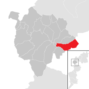
| Location of Schattendorf in the district of Mattersburg | ||
  |
||
.jpg) View of Schattendorf |
||
| Source: municipal data from Statistics Austria | ||

Schattendorf ( Hungarian : Somfalva , Croatian : Šundrof ) is a market town in the district of Mattersburg in Burgenland in Austria . The municipal area is part of the Rosalia-Kogelberg Nature Park .
geography

The municipality of Schattendorf lies on the border with Hungary . Schattendorf is the only place in the parish.
The Rosalia-Kogelberg Nature Park is part of the municipal area.
neighboring communities
| Dresden | tree garden | |
| Rohrbach near Mattersburg |
.svg)
|
|
| Loipersbach | Hungary |
story
Before the birth of Christ, the area was part of the Celtic kingdom of Noricum and belonged to the area surrounding the Celtic hilltop settlement of Burg on the Schwarzenbacher Burgberg . Later in the Roman Empire the area was part of the province of Pannonia .
Like the entire Burgenland, the town belonged to Hungary (German-West Hungary) until 1920/21. Since 1898, the Hungarian place name Somfalva had to be used due to the Magyarization policy of the government in Budapest . After the end of the First World War , after tough negotiations, German-West Hungary was ceded to Austria in the 1919 treaties of St. Germain and Trianon . The place has belonged to the newly founded federal state of Burgenland since 1921 (see also History of Burgenland ).
Schattendorf judgment
.jpg)
On January 30, 1927, in Schattendorf, three members of the right-wing front fighters' association of German-Austria shot at the clearly superior in numbers but unarmed participants in a demonstration by the Republican Protection League directed against them, killing six-year-old Josef Grössing and the Klingenbacher Schutzbündler Matthias Csmarits. The perpetrators were acquitted by a jury on the grounds of self-defense.
On July 15, 1927, one day after the Schattendorf judgment , angry workers gathered in front of the Palace of Justice in Vienna, stormed it and then set it on fire; the government of Ignaz Seipel ordered the suppression of the demonstration. The so-called July revolt claimed 89 lives, including on the part of the police; the burnt down palace of justice and the aggravated political climate were additional steps into the civil war .
On June 2nd, 2007 the exhibition Schattendorf 1927 was opened.
Economic crisis of 1929
The global economic crisis of 1929 hit Burgenland very hard. The unemployment rate was higher than ever before, mainly because a particularly large number of Schattendorfers were employed in the construction industry as bricklayers or unskilled workers. For the rural population in particular, owning land became increasingly important. Due to the continuing economic crisis, the number of members of paramilitary organizations also grew.
1956 Hungarian uprising
After the declaration of “ perpetual neutrality ” had worked in Austria, neighboring Hungary also wanted to introduce such a declaration. However, it failed there, leading to a literal civil war and an enormous movement of refugees. The stream of refugees began on November 4, 1956. On that day alone, 500 people who needed food and shelter arrived in Schattendorf. They were billeted in inns and vacant classrooms at the school. In view of the large number of refugees, aid organizations were overwhelmed. Therefore, numerous women from Schattendorf took care of the refugees. By March 1957 around 200,000 people had fled to Burgenland. Many of them traveled further. However, some remained near the border area in the hope of returning home soon.
Austria received great international recognition for its willingness to help. The great escape finally ended in December 1956. The “ Iron Curtain ” , dismantled in September , was rebuilt. But this end did not mean the end of the flight movement. Especially in Schattendorf, mostly young Hungarians who had crossed the border in a spectacular way kept turning up.
population development

Culture and sights
.jpg)
.jpg)
- Schattendorf parish church dedicated to St. Michael the Archangel: Built around 1703, the tower added in 1747.
- Rosalia-Kogelberg Nature Park : Opened in 2006, the nature park is around 7,000 hectares in size
- Schuhmühle - museum, culture & communication house: permanent exhibition "Schüsse von Schattendorf", history of the mill
Economy and Infrastructure
education
.jpg)
.jpg)
.jpg)
Investing in education began in Schattendorf as early as 1954. A conversion and extension of the elementary school was the beginning. Just two years later, in 1956, a home economics school for girls was started at a local inn. In September 1957, the municipal council decided to build a secondary school. In 1963 the planning and financing of the project began for this purpose. This not only benefited the community itself, but also the neighboring communities of Loipersbach , Baumgarten and Draßburg . The Hauptschule was opened on November 6, 1966. This was another big step for the school system.
1957 also saw the start of the construction of the kindergarten in the Schattendorf vicarage. Only in 1992 did the kindergarten change ownership. From then on it was owned by the municipality. In 1995 the municipal council made the decision to build a new kindergarten, which was completed and opened in 1996. Since the 2009/10 school year, the Schattendorf secondary school has been converted into a new middle school.
politics
council
Due to the number of inhabitants, the municipal council has a total of 23 members.
| Political party | 2017 | 2012 | 2007 | 2002 | 1997 | ||||||||||
|---|---|---|---|---|---|---|---|---|---|---|---|---|---|---|---|
| pen | % | M | pen | % | M | pen | % | M | pen | % | M | pen | % | M | |
| SPÖ | 1202 | 75.65 | 18 | 1296 | 77.14 | 18 | 1276 | 75.59 | 18 | 1311 | 77.21 | 18 | 1,089 | 68.97 | 15 |
| ÖVP | 254 | 15.98 | 4 | 292 | 17.38 | 4 | 348 | 20.62 | 5 | 302 | 17.79 | 4 | 300 | 19.00 | 4 |
| FPÖ | 116 | 7.30 | 1 | 92 | 5.48 | 1 | 64 | 3.79 | 0 | 85 | 5.01 | 1 | 190 | 12.03 | 2 |
| BLS A1 | 17 | 1.07 | 0 | not a candidate | not a candidate | not a candidate | not a candidate | ||||||||
| eligible voters | 2092 | 2150 | 2140 | 2081 | 1986 | ||||||||||
| voter turnout | 81.31% | 84.56% | 83.60% | 87.70% | 89.22% | ||||||||||
community board
In addition to Mayor Johann Lotter (SPÖ) and Deputy Mayor Thomas Hoffmann (SPÖ), Dieter Dorfmeister (SPÖ), Silvia Moser (SPÖ), Thomas Plank (SPÖ), Rainer Schlögl (SPÖ) and Christian Schuh (ÖVP) are also on the municipal board.
Treasurer is Thomas Bernhardt (SPÖ).
Mayor
The mayor is Johann Lotter (SPÖ), who succeeded Alfred Grafl (SPÖ) on February 2, 2012. In the mayoral direct election in 2017, he was confirmed in office with 78.68%. His two competitors Christian Schuh (ÖVP) and Jennifer Pauer (BLS) achieved 18.05% and 3.27% respectively.
As part of the constitutive meeting of the municipal council, Thomas Hoffmann (SPÖ) was elected vice mayor.
Richard Grasl is the head of the office.
Past Mayors
Source: Atlas Burgenland
- 1923 Johann Grafl ( CS )
- 1931 Johann Trimmel (opposition party)
- 1934 Johann Bauer ( Fatherland Front )
- 1938 Michael Plank (community manager)
- 1945-1952 Michael Pinter (SPÖ)
- 1952-1957 Stefan Simon (SPÖ)
- 1957-1977 Matthias Pinter (SPÖ)
- 1977-1987 Herbert Pinter (SPÖ)
- 1987-2012 Alfred Grafl (SPÖ)
- since 2012 Johann Lotter (SPÖ)
coat of arms
|
|
In 1999, the community received the right to use a coat of arms and was made a market community in 2003 (publication in LGBl. Nr. 24/2003). Blazon : "In a shield divided by blue and silver, a silver row of houses at the top and a row of blue fallen houses with a church in the middle". |
community partnerships
sons and daughters of the community
- Michael Pinter (1899–1954), clerk and Austrian politician ( SPÖ )
- Josef Hans Grafl (1921–2008), Austrian resistance fighter against National Socialism
- Matthias Pinter (1922–1996), headmaster and Austrian politician ( SPÖ )
- Fritz Ostermayer (born 1956), Austrian journalist, author, DJ and musician
- Josef Ostermayer (born 1961), Austrian politician ( SPÖ )
- Chris Haring (born 1970), Austrian dancer and choreographer
web links
- 10612 - Shadow Village. Community data, Statistics Austria .
- community Schattendorf
itemizations
- ↑ http ://www. Schattendorf.at/index.php/geschichte.html
- ↑ Market community Schattendorf: SCHATTENDORF. Its History and Its People 2003, pp. 93–94
- ^ Market community Schattendorf: Schattendorf - Its history and its people 2003, pp. 106-107
- ↑ Mühle Schattendorf - experience, communication and culture , retrieved on January 29, 2017.
- ^ Market community Schattendorf: Schattendorf - Its history and its people 2003, pp. 109-110
- ↑ a b Land Burgenland: Election result Schattendorf 2017 (retrieved on December 8, 2017)
- ↑ Land Burgenland: Election result Schattendorf 2012 (retrieved on December 8, 2017)
- ↑ Land Burgenland: Election result Schattendorf 2007 (retrieved on December 8, 2017)
- ↑ a b Land Burgenland: Election result Schattendorf 2002 (retrieved on December 8, 2017)
- ↑ a b c Marktgemeinde Schattendorf: Municipal Council (accessed December 9, 2017)
- ↑ a b Market community Schattendorf: Mayor (accessed August 12, 2019)
- ↑ Marktgemeinde Schattendorf: Municipal Administration (accessed December 9, 2017)
- ↑ Atlas Burgenland: Schattendorf (accessed December 9, 2017)
- ↑ http ://www. Schattendorf.at/index.php/wappen.html
- ↑ Marktgemeinde Schattendorf: Partnergemeinde (accessed December 9, 2017)
Antau | Bad Sauerbrunn | Arboretum | Dresden | Forchtenstein | brain | Krensdorf | Loipersbach in Burgenland | March | Mattersburg | Neudörfl | Pöttelsdorf | Pöttsching | Rohrbach near Mattersburg | shadow village | Sieggraben | Sigleß | Meadows | Zemendorf-Stöttera