Alexandroupoli
|
Alexandroupoli municipality Δήμος Ἀλεξανδρούπολης (Αλεξανδρούπολη) |
||
|---|---|---|
|
|
||
| Basic data | ||
| State : |
|
|
| Region : | East Macedonia and Thrace | |
| Regional District : | Evros | |
| Geographic coordinates : | 40 ° 52 ' N , 25 ° 53' E | |
| Area : | 1,219.94 km² | |
| Residents : | 72,959 (2011) | |
| Population density : | 59.8 inhabitants / km² | |
| Post Code: | 68100 | |
| Prefix: | (+30) 25510 | |
| Seat: | Alexandroupoli | |
| LAU-1 code no .: | 0301 | |
| Districts : | 3 municipal districts | |
| Local self-government : |
3 city districts 14 local communities |
|
| Website: | alexpolis.gr | |
| Location in the region of East Macedonia and Thrace | ||
Alexandroupoli ( Greek Αλεξανδρούπολη [ alɛksanðrupɔli ] ( f. Sg. ), Older even Alexandroupolis Αλεξανδρούπολις, Turkish Dedeağaç, Bulgarian Дедеагач Dedeagatsch , gr. To 1920 Dedeagats Δεδέαγατς) is one Greek port city and municipality ( dimos δήμος) in Western Thrace and former seat of the prefecture Evros .
geography
Alexandroupoli is located directly on the Thracian Sea , a tributary of the Aegean Sea . It forms the southern border of the city. In the west, Alexandroupoli borders the municipalities of Arriana and Maronia-Sapes in the Rodopi regional district, in the north on the municipality of Soufli and in the east on the Turkish province of Edirne .
history
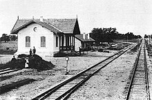
In 1870 the construction of the Edirne - Selanik - Istanbul (Constantinople) line of the Orientbahn began , which initiated the development of the city in the Ottoman Empire . The city was founded in 1871 under the name Dedeağaç as part of the Ottoman Vilâyet Edirne . The name is made up of the Turkish words, Dede - a designation of honor - and Ağaç (tree). The city was founded during the completion of the Dedeağaç branch of the Rumelia Railway, which was in use from 1872. Trade in the city flourished, so that as early as 1883 Dedeağaç ousted Dimetoka's importance as the center of the Sanjak of the Vilayet Edirne. In 1894 the Sanjak Dedeağaç consisted of the Kazas (districts) Dedeağaç, Enez and Sofrulu . The Kaza Dedeağaç consisted of the three Nahies (communes) Ferecik , Meğri and Semadirek and 41 villages.

From 1894, the city became the starting point of a strategic railway line to Thessaloniki , with which this city was connected directly to the rail network of the Ottoman Empire and no longer had to use the routes over Serbian and Bulgarian territory. The route was created by the Société du Chemin de Fer Ottoman Jonction Salonique-Constantinople (JSC), which was mainly financed by French donors.
During the First Balkan War , the city was occupied by Bulgaria at the end of 1912 and was henceforth the most important Aegean port in the country as Дедеагач / Dedeagatsch . At that time there were 185,000 Turks, 25,500 Bulgarians, 22,000 Greeks and 2,200 inhabitants of other ethnic groups in Western Thrace. Because of the threat of annexation to Bulgaria, resistance formed in the Muslim-Turkish population, which led to the Provisional Government of Western Thrace . Greece supported the establishment of such a republic with the aim of influencing the negotiations between the Ottoman Empire and Bulgaria, which were taking place in Constantinople at the same time, so that no peace could be reached between the two countries.
In September 1913, after the end of the Second Balkan War, over 12,000 Bulgarian refugees found temporary asylum on the outskirts of the city. They had fled ethnic cleansing from 17 different villages across western Thrace.
In the Treaty of Neuilly on November 27, 1919, Bulgaria had to cede the city to the Entente . According to the census carried out by the French administration in early 1920, the city had 7,222 inhabitants, including 3,900 Bulgarians, 2,500 Greeks, 512 Armenians, 165 Jews, 195 Turks. In the Treaty of Sevres of August 10, 1920 the city was awarded Greece and in Alexandroupoli - after King I. Alexander - renamed. Subsequently, Bulgarians had to leave the city according to the population exchange agreed in the Treaty of Neuilly-sur-Seine . A total of 53,000 Bulgarians were expelled from Greece after 1920. Conversely, 46,000 Greeks were expelled from Bulgaria.
Administrative division
The municipality of Alexandroupoli was created as part of the 2010 administrative reform from the previous municipalities of Alexandroupoli, Traianoupoli and Feres. Since then, these have had the status of municipal districts. The administrative seat of the municipality is the city of Alexandroupoli.
| Parishes | Greek name | code | Area (km²) | 2001 residents | Residents 2011 | City districts / local communities (Δημοτική / Τοπική Κοινότητα) |
location |
|---|---|---|---|---|---|---|---|
| Alexandroupoli | Δημοτική Ενότητα Αλεξανδρούπολης | 030101 | 642.245 | 52,720 | 61,702 | Alexandroupoli, Avas, Esymi , Kirki, Makri, Sykorrachi | |
| Traianoupoli | Δημοτική Ενότητα Τραϊανουπόλης | 030102 | 163.549 | 3,335 | 2,706 | Anthia, Doriko, Loutros, Nipsa | |
| Feres | Δημοτική Ενότητα Φερών | 030103 | 411.160 | 9,839 | 8,551 | Feres, Peplos, Ardani, Doriskos, Kavisos, Pylea, Tryfilli | |
| total | 0301 | 1,216,954 | 65,894 | 72,959 | |||
traffic
Street
Alexandroupoli is on the historic Via Egnatia . There are further connections for:
- Highway 2 ( European route 90) Istanbul - Thessaloniki - Ioannina
- National road 2 .
They begin or end in Alexandroupoli:
- National road 51 to Didymoticho , Soufli , Orestiada , Ormenio (continuation to Edirne and Swilengrad )
- National road 53 to Ormenio (Bulgarian border)
The national road 2 in its course to the east to Ardanio and the national road 51 are designated as European route 85 , the Autobahn 2 as European route 90 .
The Alexandroupoli bus station is on a street parallel to the main street Liof. Dimokratias and is the starting point for various long-distance bus routes, including to Thessaloniki (journey time around 4:15 a.m.). There is a large number of city bus routes in the urban area.
train
Alexandroupoli is on the Thessaloniki – Alexandroupoli railway and the Alexandroupoli – Swilengrad railway . From the latter, the İstanbul Sirkeci – Swilengrad railway to Istanbul branches off in Pythion . For economic reasons, however, cross-border train traffic to Turkey was discontinued in 2011.
port
From the port there are boat connections to Samothraki , Limnos and Rhodes . The connection to the neighboring island of Samothrace is operated up to twice a day, depending on the day of the week, and the crossing takes about 2:15 hours.
Airport
The Alexandroupoli airport is located about 7 km east of the city center.
Urban development
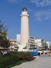
Alexandroupoli is now one of the most up-and-coming cities in Greece. One of the landmarks is the city's lighthouse, the Fáros ( Greek Φάρος) at the port.

The city should also be part of the strategically important Burgas-Alexandroupolis oil pipeline . It is supposed to connect the city of Alexandroupoli with the Black Sea city of Burgas . When Bulgaria left in 2011, this project was abandoned.
sons and daughters of the town
- Chrysopigi Devetzi (* 1976), triple jump athlete
- Konstantinos Malamatina, who in 1895 is considered to be the founder of the well-known Retsina brand (white wine) Malamatina .
- Todor Dinow (1919–2004), Bulgarian painter, is considered the father of Bulgarian animation
- Atanas Sirkarow (1919–1989), Bulgarian architect and historian
- Ioanna Filippidu (1953–1999), sculptor
- Demis Nikolaidis (* 1973), soccer player, Euro 2004 champion with the Greek national team
- Athanasios Tsigas (* 1982), football player
Twin cities
See also
swell
- ↑ Results of the 2011 census at the National Statistical Service of Greece (ΕΛ.ΣΤΑΤ) ( Memento from June 27, 2015 in the Internet Archive ) (Excel document, 2.6 MB)
- ↑ Tayyib Gökbilgin in Encyclopaedia of Islam , article Dede Aghac - Dede Aghac, now Alexandroupolis, town on the Aegean coast of Thrace, founded in 1871, after the construction of the branch railway from the main Rumeli line.
- ^ Turkish Railways
- ↑ Tayyib Gökbilgin in Encyclopaedia of Islam , article Dede Aghac
- ↑ a b Katrin Boeckh: From the Balkan Wars to the First World War. Small state politics and ethnic self-determination in the Balkans . Oldenbourg Verlag, Munich 1996, ISBN 3-486-56173-1 .
- ↑ Л. Милетичъ, Разорението на Тракийскитѣ българи прѣзъ 1913 година, р.222
- ↑ Atanas Razbojnikow / Spas Razbojnikow: Населението на Южна Тракия с оглед на народностните отношения в 1830, 1878, 1912 и 1920 година (bulg from about. The population and ethnic composition Südthrakiens in 1830, 1878, 1912 and 1920 ) Sofia 1999, p. 162.
- ↑ Elizabeth Kontogiorgi: Population Exchange in Greek Macedonia. The Rural Settlement of Refugees 1922-1930 . Clarendon Press, Oxford 2006, ISBN 0-19-927896-2 , p. 229.
Web links
- History of Alexandroupolis ( Memento from June 1, 2009 in the Internet Archive ) (only in Greek)
- City information ( Memento of July 2, 2008 in the Internet Archive ) (English)
- Greek Travel Pages (English)


