Pangeo (municipality)
|
Municipality of Pangeo Δήμος Παγγαίου (Παγγαίο) |
||
|---|---|---|
|
|
||
| Basic data | ||
| State : |
|
|
| Region : | East Macedonia and Thrace | |
| Regional District : | Kavala | |
| Geographic coordinates : | 40 ° 52 ' N , 24 ° 9' E | |
| Area : | 698.01 km² | |
| Residents : | 32,085 (2011) | |
| Population density : | 46 inhabitants / km² | |
| Community logo: | ||
| Seat: | Eleftheroupoli | |
| LAU-1 code no .: | ||
| Districts : | 5 municipal districts | |
| Local self-government : |
3 city districts 27 local communities |
|
| Website: | www.dimospaggaiou.gr | |
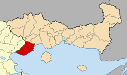
| Location in the region of East Macedonia and Thrace | ||
Pangeo ( Greek Παγγαίο [ paŋˈgʲɛɔ ] ( n. Sg. )) Is a municipality in the Greek East Macedonia and has its seat in the small town Eleftheroupoli , which is also the largest settlement of the municipality with 4,360 inhabitants. Other small towns in the municipality are Nea Peramos (3,514 inhabitants) and Nikisiani (2,236 inhabitants).
The villages and settlements of Pangeos were administered in the late Ottoman Empire in Kaza Pravişte by today's Eleftheroupoli (then in Greek Pravi, Slavic Pravišta ), which was followed in the Kingdom of Greece after 1913 by the province of Pangeo as an administrative unit. From 1997 to 2010 the villages formed five municipalities with the abolition of the province, which were merged in 2011 to form the municipality of Pangeo.
geography
Pangeo has a share in the south and east of the eponymous mountain range Pangeo , whose highest peak ( 1956 m ) lies on the border with the northwestern neighboring municipality of Amfipoli . The mountain range of Symvolo ( 1298 m ) runs parallel to the Pangeo and on the coast of the Aegean Sea bordering to the south in the municipality. An extensive valley stretches between the two, in which numerous villages line up. This valley is drained by the Marmaras River and its tributaries from both mountain ranges. The Marmaras flows for 30 km from northeast to southwest and turns south at Akropotamos, where it has dug a gorge to the Aegean Sea through the western foothills of the Symvolo, into which it flows. Its catchment area is 237 km².
This valley is separated to the west by a low pass from the alluvial land at the mouth of the Strymonas ; in the northeast is at Akrovouni (Panagia) the pass to the plain of Philippi , to which the area around Eleftheroupoli belongs. This plain is not drained to the nearby coast in the south, but via the Angitis, which flows north from the Pangeo near Nikisiani to the west and flows into the Strymonas. The neighboring communities here are Doxato and to the east of Kavala .
The Symvolo shields the Marmaras Valley from the northern Aegean coast , which is so steep here that there is no room for any major coastal towns. Only in the east of the municipality does it slope more gently to the sea. Nea Perama and Nea Iraklitsa in the east are here on two neighboring bays, the former on the Bay of Eleftheres, the latter further north on the Gulf of Paleo. In the south of the Bay of Eleftheres, Cape Vrasida pushes into the sea, together they form a natural harbor. At Nea Peramos, a small mountain river also flows into the sea, which has formed a small floodplain to the west of Eleftheres that can be used for agriculture.
history
Early and ancient times
The Pangeo and Symvolo mountains were used very early on for metal extraction. Thracian tribes settled in the area before the turn of the 1st millennium BC . One of the old names for the area between Pangeo and Symvolo was after the Thracian tribe of the Pierer Pieris, who are also considered to be the founders of the city of Phagrēs ( Φάγρης ) at the entrance to the Marmaras Valley and who have long inhabited the valley undisturbed. Herodotus reports that the Phoenicians were the first colonists on the island of Thasos, who also mined the gold of Pangaion. These are mostly interpreted by science as supporters of the Mycenaean culture . From around 680 Thasos was taken by colonists from the island of Paros , who took the mainland opposite from there; As a result, the area of the Pangeo, Symvolo and Lekani Mountains was administered as Thasitic Peraia (in ancient Greek πέραν peran 'opposite') from Thasos. The trading centers Oisymē ( Οἰσύμη ) and Galēpsos ( Γαληψός ) were Thasitic foundations and are located in the coastal area of the municipality. The west of the Pangeo was under the influence of a Thracian city that was colonized by Athens in classical times and called Amphipolis . Together with Thasos, the Peraia got into the conflict between Athens and Sparta several times in the 5th century and was conquered several times. However, the Greek colonization only reached as far as the Thracian coast and the coastal plains. The hinterland further north belonged temporarily to the domain of the Thracian Odrysen .
Macedonia and Byzantium (168 BC to 1371)
In 356 BC In BC Philip II of Macedonia took Amphipolis, and in the following years the entire area of Pangeos. In 340 all of Thrace was in Macedonian hands. In the Third Macedonian-Roman War in 168 BC The Roman Empire conquered the area and finally smashed Macedonia, Pangeo belonged to the subsequently installed Roman province of Macedonia and has since been assigned to Eastern Macedonia instead of Thrace. Around 146 BC The Roman highway Via Egnatia was built, connecting Rome with Byzantium. It ran between Amphipolis and Philippi north around the Pangeo and did not touch the municipality directly.
The immigration of Slavs to the Balkan Peninsula in the 7th century left the native Byzantine population in the coastal areas largely untouched, and the Greek-speaking population was largely able to maintain itself in the Pangeo area. Nevertheless, many place names of Slavic origin also indicate Slavic inhabitants of Pangeos. With the rest of the now multi-ethnic Macedonia, Pangeo was caught in the tension between the Byzantine Empire , the early Bulgarian empires and the Frankish states as a result of the Fourth Crusade . It changed rulers several times over the centuries, but was on the periphery of the contested cities and areas.
Ottoman period (1371-1913)

After Macedonia was conquered by the Ottoman Empire ( Kavala fell in 1371), the Turkish population was settled in the Marmaras Valley in particular, and the local population was partly Islamized.
The Ottoman Kaza Pravişte, who was administered by the city of the same name, has been part of the Sanjak drama in Vilayet Saloniki since 1864 . The ethnographic studies carried out only at this time allow the following conclusion about the population of Pangeo: The Turkish population concentrated on the Marmaras valley and the northern flank of the Pangeo, the Greek on Nikisiani and the villages in the east of the Symvolo, Kučkari (Eleochori) was a Muslim-Slavic village, Muslim Roma lived in the small village of Tsifliki and formed considerable minorities in Pravišta and Kariani. In Leftera (Eleftheres) lived next to Orthodox Greeks an equally large number of Muslim Greeks.
Pangeo in Greece
During the First Balkan War in 1913, Bulgaria captured Pangeo, which shortly afterwards came to Greece as a result of the Second Balkan War through the Treaty of Bucharest . The most abrupt change in Pangeo was brought about by the population exchange between Greece and Turkey after 1923, through which the expulsion of the Muslims Pangeos to Turkey was sanctioned and Christian refugees from Eastern Thrace and Anatolia were settled in their villages. The small village of Kale Čiflik grew into a real town as Nea Peramos because of the newcomers, while in Nikisiani, which was always Greek, little changed.
The population of the Pangeo province after the population exchange is documented in the Greek census of 1928, which also recorded the place of birth and mother tongue of the inhabitants. According to this, 26,015 people lived in Pangeo, of whom 12,218 were born in Greece and 13,797 outside of Greece (7,640 of them in Asia Minor, 3506 in non-Greek Thrace and 1935 on the Black Sea). The main mother tongues were Greek (24,136 people) and Turkish (1498), as well as Armenian (280) and Koutzovlachian (76), and only one resident was recorded as speaking "Macedonoslav".
In Greece, the Pangeos area was initially administered as a province with numerous municipalities. Most of the villages and communities with non-Greek names were renamed in the course of the 20th century, for example Kučkari in Eleochori ('olive village') or Kale Čiflik in Nea Peramos after Peramos on the Marmara Sea, today's Karşıyaka on the Kapıdağ Peninsula from which most of the refugees came.
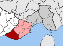
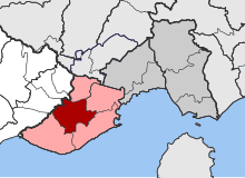
In 1997 the now 30 municipalities of Pangeos were grouped into five new municipalities: Pangeo with the villages on the northern flank of the mountain around Nikisiani, Eleftheroupoli around the now so-called former Pravi with the northern municipalities of the Marmara Valley, south of the Symvolo on the coast of Eleftheres, based in Nea Peramos, Pieris after the old name of the landscape with seat in Moustheni in the lower Marmara valley, finally Orfano, administered by Galypsos in the west to the Aegean coast. In 2011, these five municipalities were reunited to form the larger municipality of Pangeo, as part of the Kallikratis program .
Economy and Infrastructure
The community is dominated by agriculture. In the east of the municipality and in the Marmaras Valley, this is mainly tobacco production, which has contributed to Kavala's importance as a tobacco trading center, but also wheat and corn cultivation in the Philippi plain. On the southern slope of the Symvolo, viticulture dominates , table grapes, wine and tsipouro are produced. Myrtofyto has one of the most modern filling plants for Tsipouro in Greece. Olive groves line up between the vineyards . In the higher villages on the Pangeo, the chestnut harvest and beekeeping also play a role, as some place names suggest, in the west also the cultivation of almonds . There is cattle farming throughout the municipality, which among other things is used for local cheese production.
Fishing has a long tradition on the coast, between Nea Peramos and Nea Iraklitsa there is a national research institute for fisheries with an attached library and museum.
Tourism also plays the largest role on the coast, the places on the western coast of the municipality have extensive sandy beaches and the appropriate infrastructure for bathing tourism. Nea Peramos and Iraklitsa also offer berths for sailing yachts and water sports. The proximity to the city of Kavala 14 km to the east has also created a large gastronomic offer. The mountain regions with caves and picturesque landscapes, ruins of old monasteries and old stone bridges over the mountain streams are ideal for excursions.
The Greek A2 , the main east-west connection in northern Greece, runs through the Marmaras Valley . In the east it crosses the Symvolo massif in a tunnel and then reaches Nea Iraklitsa, a little further northeast of Kavala. National Road 2 runs directly on the coast parallel to the route of the motorway. Kavala International Airport is around 30 kilometers east of Kavala. There is no railway connection.
Administrative division
The 30 municipalities that were independent until 1997 now form urban districts (singular in Greek dimotiki kinotita , for places with more than 2,000 inhabitants) or local communities (singular topiki kinotita ) that elect their own local representatives. The population figures come from the results of the 2011 census.
-
Eleftheres parish - Δημοτική Ενότητα Ελευθερών - 9,082
- Municipality of Nea Peramos - Δημοτική Κοινότητα Νέας Περάμου - 3,532
- Agia Marina - Αγία Μαρίνα - 5
- Agios Athanasios - Άγιος Αθανάσιος - 13
- Nea Peramos - Νέα Πέραμος - 3.514
- Local community Agios Andreas - Τοπική Κοινότητα Αγίου Ανδρέου - Άγιος Ανδρέας - 411
- Local community Eleochori - Τοπική Κοινότητα Ελαιοχωρίου -
1.222
- Eleochori - Ελαιοχώρι - 1,195
- Paralia Eleochoriou - Παραλία Ελαιοχωρίου - 27
- Local community Eleftheres - Τοπική Κοινότητα Ελευθερών - Ελευθερές - 1,303
- Local community Folea - Τοπική Κοινότητα Φωλεάς - 576
- Folea - Φωλεά - 567
- Pyrgos - Πύργος - 9
- Local community Myrtofyto - Τοπική Κοινότητα Μυρτοφύτου - 433
- Myrtofyto - Μυρτόφυτο - 424
- Paralia Myrtofytou - Παραλία Μυρτοφύτου - 9
- Local community Nea Iraklitsa - Τοπική Κοινότητα Νέας Ηρακλίτσης - 1.605
- Apovathra - Αποβάθρα - 45
- Nea Iraklitsa - Νέα Ηρακλίτσα - 1,560
- Municipality of Nea Peramos - Δημοτική Κοινότητα Νέας Περάμου - 3,532
- Eleftheroupoli municipality - Δημοτική Ενότητα Ελευθερούπολης - 9,492
- Eleftheroupoli district - Δημοτική Κοινότητα Ελευθερούπολης - 5,555
- Chortokopi - Χορτοκόπι - 398
- Dasiko Chorio - Δασικό Χωριό - 0
- Eleftheroupoli - Ελευθερούπολη - 4,360
- Exochi - Εξοχή - 142
- Panagia - Παναγιά - 655
- Local community Amisiana - Τοπική Κοινότητα Αμισιανών - Αμισιανά - 927
- Local community Andifilippi - Τοπική Κοινότητα Αντιφιλίππων - Αντιφίλιπποι - 869
- Local community Chrysokastro - Τοπική Κοινότητα Χρυσοκάστρου - 322
- Chrysocastro - Χρυσόκαστρο - 307
- Moni Agiou Pandeleimonos - Μονή Αγίου Παντελεήμονος - 15
- Local community Kipia - Τοπική Κοινότητα Κηπίων - 347
- Ano Chortokopi - Άνω Χορτοκόπι - 22
- Kipia - Κηπία - 325
- Local community Kokkinochoma - Τοπική Κοινότητα Κοκκινοχώματος - Κοκκινόχωμα - 1.472
- Eleftheroupoli district - Δημοτική Κοινότητα Ελευθερούπολης - 5,555
- Orfano municipality - Δημοτική Ενότητα Ορφανού - Ορφανό - 5,249
- Local community Akropotamos - Τοπική Κοινότητα Ακροποτάμου - 675
- Akropotamos - Ακροπόταμος - 675
- Loutra Eleftheron - Λουτρά Ελευθερών - 0
- Local community Galipsos - Τοπική Κοινότητα Γαληψού - Γαληψός - 414
- Local community Kariani - Τοπική Κοινότητα Καριανής - 664
- Kariani - Καριανή - 591
- Vrysi - Βρύση - 73
- Local community Ofrynio - Τοπική Κοινότητα Οφρυνίου - 1,904
- Ofrynio - Οφρύνιο - 758
- Paralia Ofryniou - Παραλία Οφρυνίου - 1.146
- Local community Orfani - Τοπική Κοινότητα Ορφανίου - 706
- Megas Alexandros - Μέγας Αλέξανδρος - 50
- Orfani - Ορφάνι - 656
- Local community Podochori - Τοπική Κοινότητα Ποδοχωρίου - 886
- Kokkinochori - Κοκκινοχώρι - 278
- Podochori - Ποδοχώρι - 608
- Local community Akropotamos - Τοπική Κοινότητα Ακροποτάμου - 675
- Municipality of Pangeo - Δημοτική Ενότητα Παγγαίου - 4,251
- Nikisiani district - Δημοτική Κοινότητα Νικήσιανης - Νικήσιανη - 2.236
- Local community Georgiani - Τοπική Κοινότητα Γεωργιανής - Γεωργιανή - 611
- Local community Paleochori - Τοπική Κοινότητα Παλαιοχωρίου - Παλαιοχώρι - 1.404
- Pieris municipality - Δημοτική Ενότητα Πιερέων - Πιερείς - 4.011
- Local community Avli - Τοπική Κοινότητα Αυλής - 504
- Avli - Αυλή - 504
- Palia Avli - Παλιά Αυλή - 0
- Local community Domatia - Τοπική Κοινότητα Δωματίων - Δωμάτια - 457
- Local community Melissokomio - Τοπική Κοινότητα Μελισσοκομείου - 424
- Melissokomio - Μελισσοκομείο - 284
- Pyrgochori - Πυργοχώρι - 140
- Local community Mesia - Τοπική Κοινότητα Μεσιάς - 379
- Melissa - Μέλισσα - 209
- Mesia - Μεσιά - 170
- Local community Mesoropi - Τοπική Κοινότητα Μεσορόπης - Μεσορόπη - 456
- Local community Moustheni - Τοπική Κοινότητα Μουσθένης - Μουσθένη - 647
- Local community Platanotopos - Τοπική Κοινότητα Πλατανοτόπου - Πλατανότοπος - 584
- Local community Sidirochori - Τοπική Κοινότητα Σιδηροχωρίου - 560
- Karavangelis - Καραβαγγέλης - 371
- Sidirochori - Σιδηροχώρι - 189
- Local community Avli - Τοπική Κοινότητα Αυλής - 504
Individual evidence
- ↑ a b Results of the 2011 census at the National Statistical Service of Greece (ΕΛ.ΣΤΑΤ) ( Memento from June 27, 2015 in the Internet Archive ) (Excel document, 2.6 MB)
- ^ Marmaras on the pages of the Greek Ministry of Agriculture
- ^ William Smith: Dictionary of Greek and Roman Geography, London 1854
- ↑ Max Vasmer : The Slavs in Greece . Berlin 1941, Leipzig 1970, list of Slavic place names in Greece online
- ^ Extensive collection of sources on the population of the villages around Pravi by Dimitri Lithoxoou, accessed on May 25, 2014 (Greek)
- ↑ Results of the Greek population censuses from 1879–2001, available as PDF under http://dlib.statistics.gr/portal/page/portal/ESYE/categoryyears?p_cat=10007862&p_topic=10007862
- ↑ Greek Law Gazette No. 1292 of August 11, 2010 (PDF, 555 kB)


