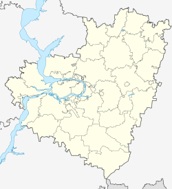
Alexejewka (Samara, Kinel)
| Urban-type settlement
Alexejewka
Алексеевка
|
||||||||||||||||||||||||||||||||
|
||||||||||||||||||||||||||||||||
|
||||||||||||||||||||||||||||||||
| List of large settlements in Russia | ||||||||||||||||||||||||||||||||
Alexejewka ( Russian Алексе́евка ) is an urban-type settlement in Samara Oblast ( Russia ) with 10,411 inhabitants (as of October 14, 2010).
geography
The settlement is located about 25 km east-northeast of the Samara Oblast Administrative Center on the right bank of the Volga tributary Samara , below the confluence of the Great Kinel .
Alexejewka belongs to the Kinel district and is located about 10 km west-northwest of the center of Kinel town.
history
The place goes back to a fortress built from 1700 near the mouth of the Kinel in the Samara, which was named after the Tsarevich Alexei as Alexejewskaja krepost . A little later, today's location was built below the fortress, also in connection with the discovery and mining of sulfur deposits , which were used locally for black powder production from 1709 onwards.
In 1877 the Samara- Slatouster Railway was passed, and in 1885 the place called Alexejewsk at that time became the administrative seat of a Volost . In connection with the establishment of various industrial plants, such as an alabaster stone factory in 1928 and a new sulfur works in 1936, Alexejewka received the status of an urban-type settlement.
1964 was the management of the City Soviet assumed by Kinel, from whose territory of today's city district emerged. The settlement has its own administration within the urban district that has existed since 2004.
Population development
| year | Residents |
|---|---|
| 1897 | 1,694 |
| 1939 | 3,936 |
| 1959 | 6,597 |
| 1970 | 6,474 |
| 1979 | 9.102 |
| 1989 | 9,179 |
| 2002 | 9,703 |
| 2010 | 10,411 |
Note: census data
traffic
The Alexejewskaja train station is located near Alexejewka at kilometer 1128 (from Moscow ) on the Samara - Ufa - Chelyabinsk line that has been electrified on this section since 1956 .
Immediately northwest of the settlement intersect the there highway-like developed regional roads 36K-851 (formerly R225) from Samara to Buguruslan and 36A-144, the long-range bypass Samara between the federal highway M5 Ural to Chelyabinsk and the regional road 36Р-069 (formerly R226) Direction Volgograd .
Individual evidence
- ↑ a b Itogi Vserossijskoj perepisi naselenija 2010 goda. Tom 1. Čislennostʹ i razmeščenie naselenija (Results of the All-Russian Census 2010. Volume 1. Number and distribution of the population). Tables 5 , pp. 12-209; 11 , pp. 312–979 (download from the website of the Federal Service for State Statistics of the Russian Federation)

